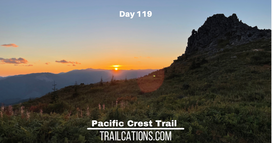
PCT Day 119
August 27, 2021
Mile: 2147.6 to 2163.1 (15.5 mi)
Start: Cheapo motel in Cascade Locks, Oregon
Finish: Epic campsite atop Three Corner Rock
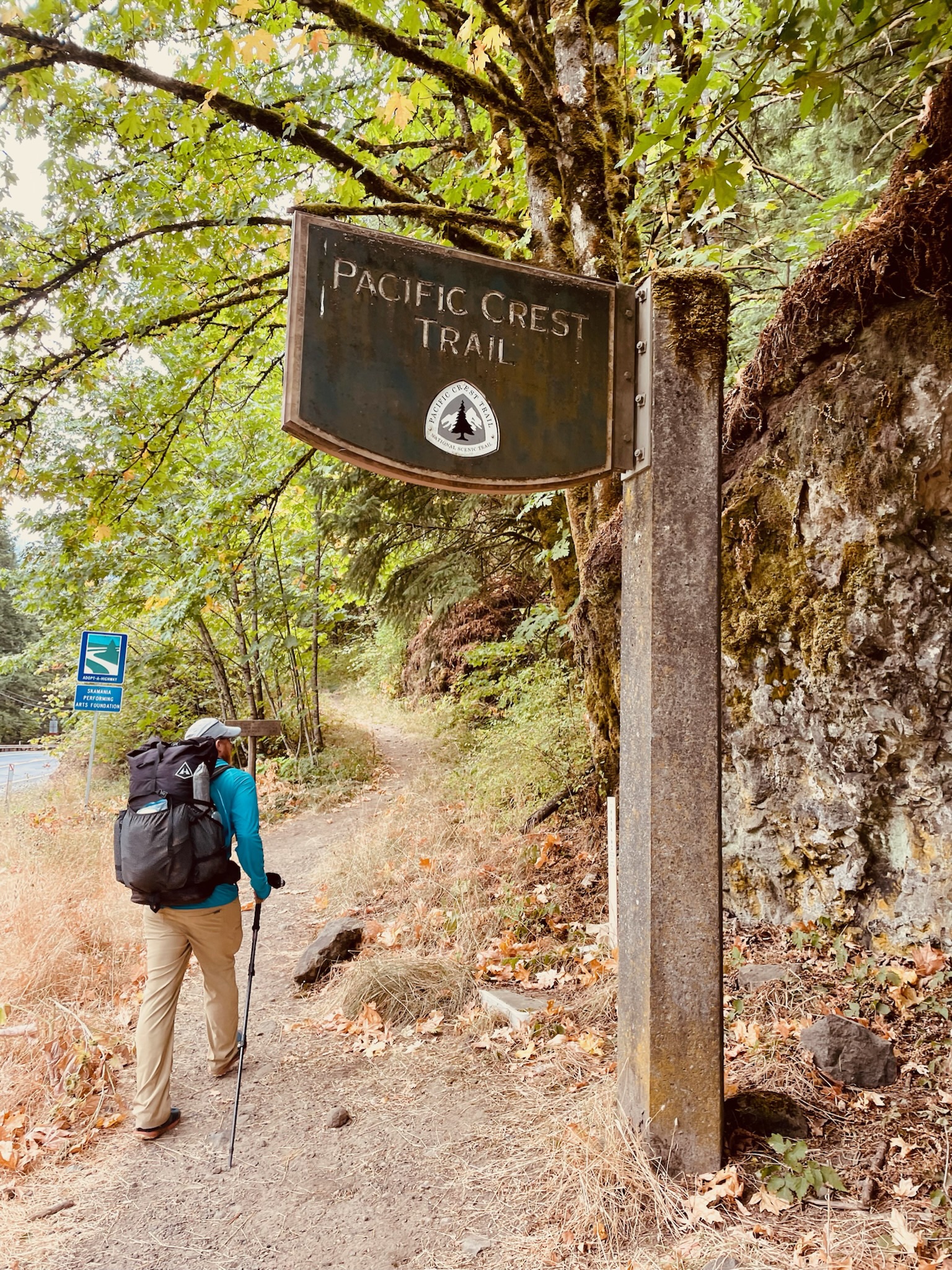
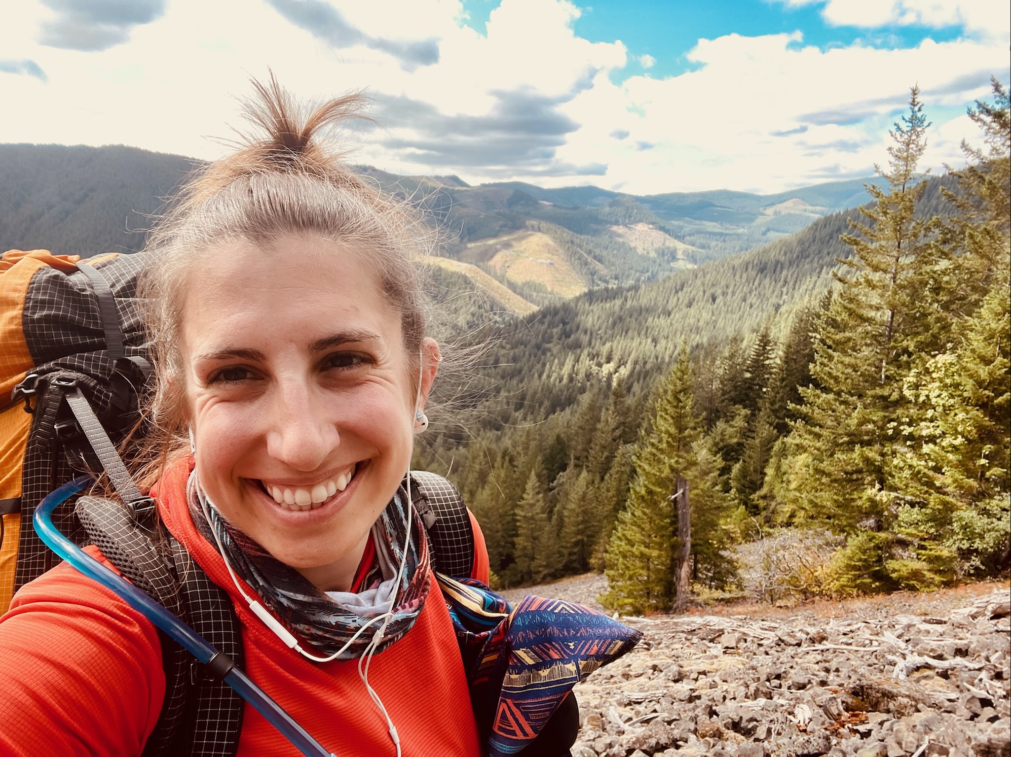
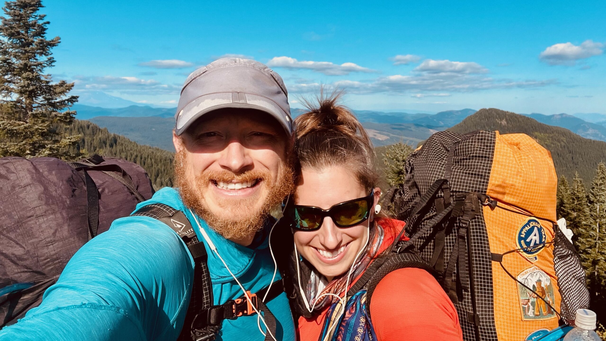
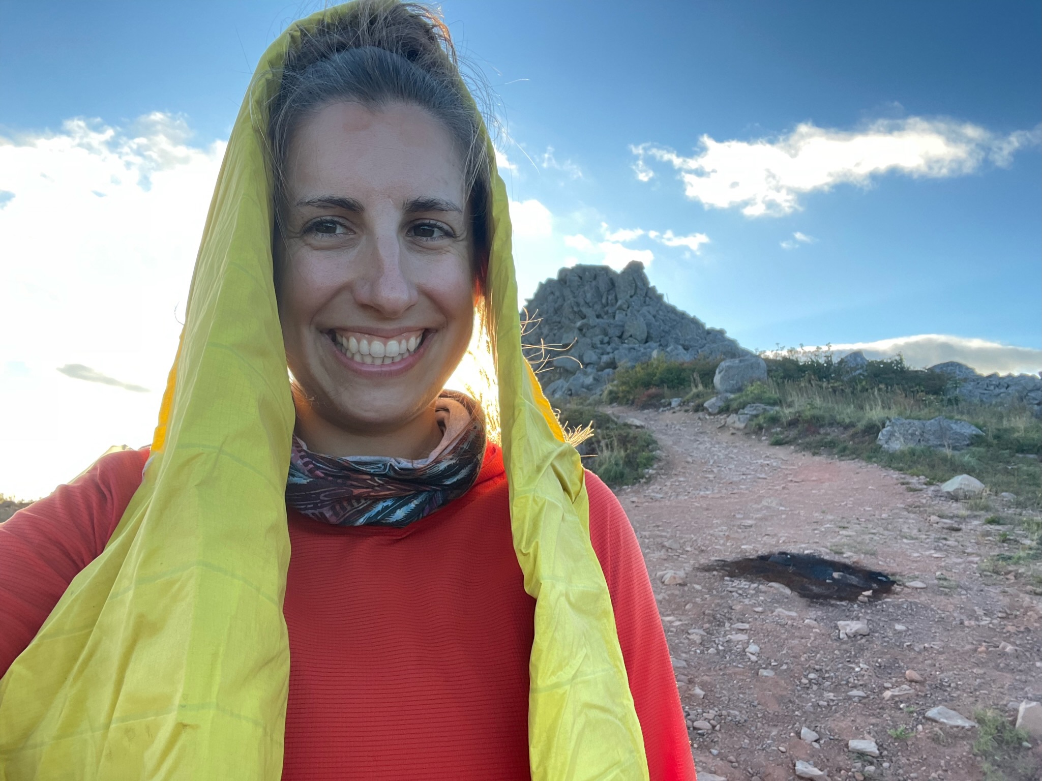
We woke up in the early dawn, hoping that it would be our lucky day to see a beautiful sunrise as we walked across the infamous Bridge of the Gods that spanned the mighty Columbia River and connected Oregon to Washington. Well the reality is that we’re in the Pacific Northwest and instead of this pipedream of early morning sunshine and clear skies, the day started out foggy, dreary and damp as per usual. We decided that it was 100% okay to sleep in a little bit instead of waking up bright and early since we would barely be able to see our hands in front of our faces with how thick the mist was. At 10 o’clock we got kicked out of the hotel and headed out to start our walk into Washington state. It was my first time ever being in Washington so I was really excited to check another state off my list – 46 US states visited, only 4 to go! Only Hawaii, Alaska, New Mexico and Oklahoma are left on my list.
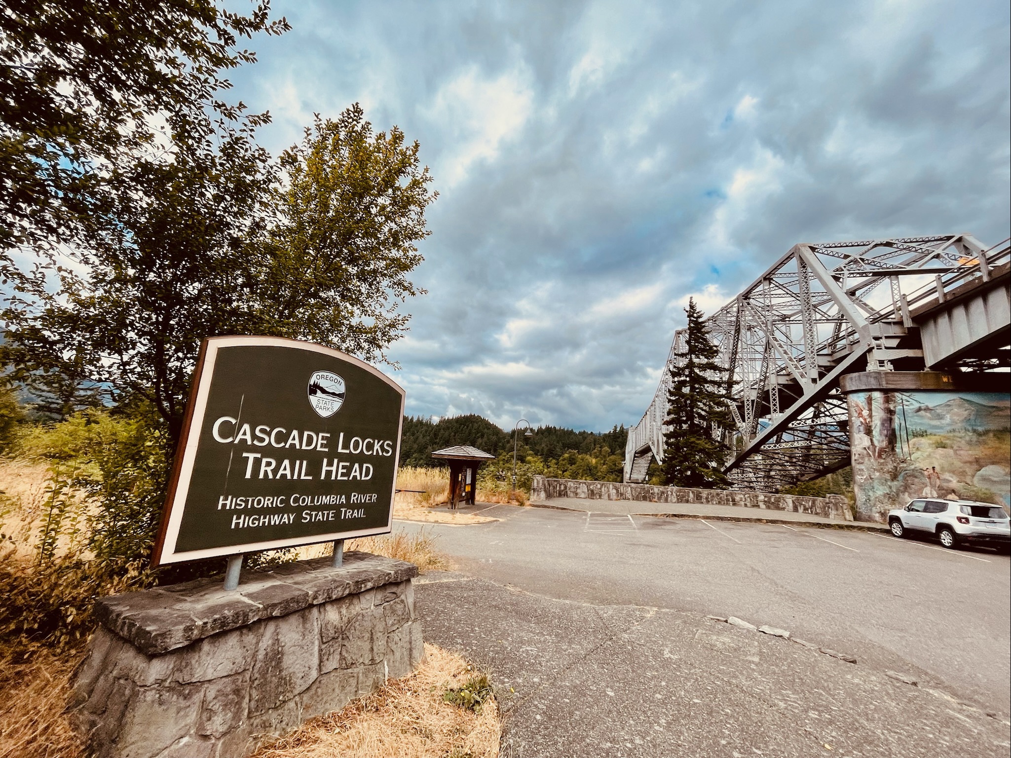
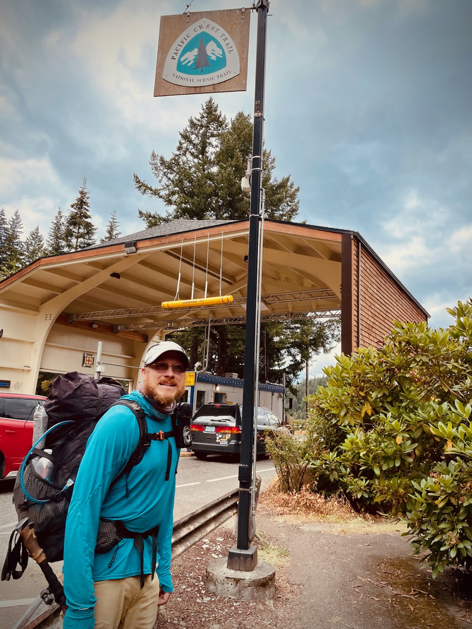
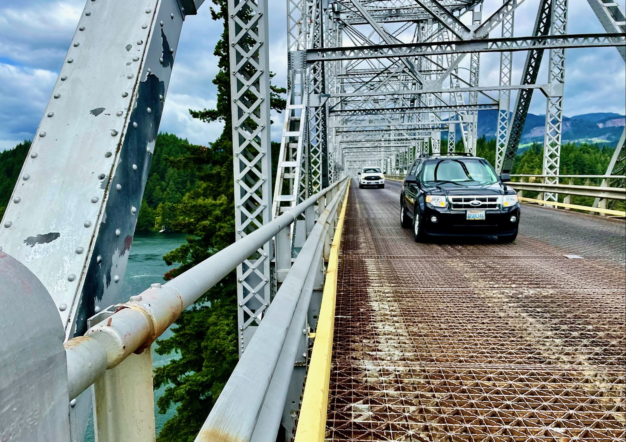
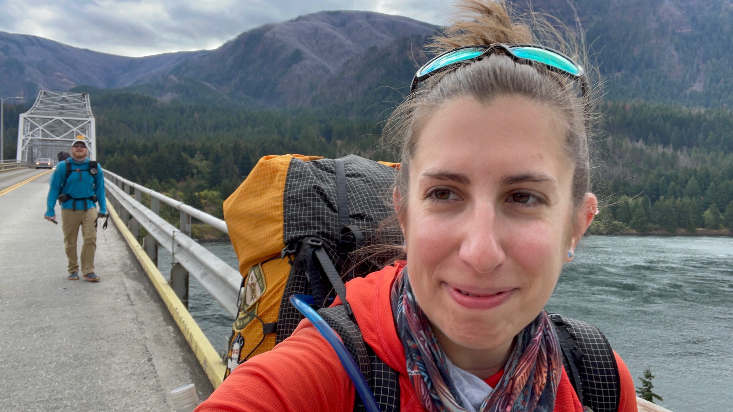
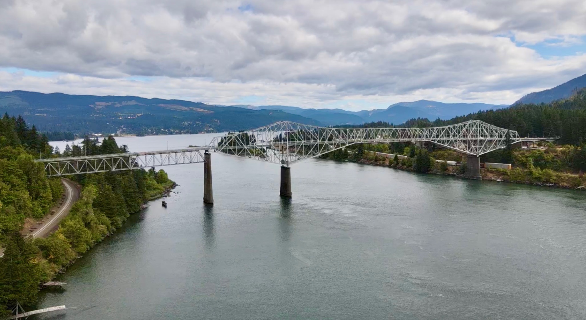
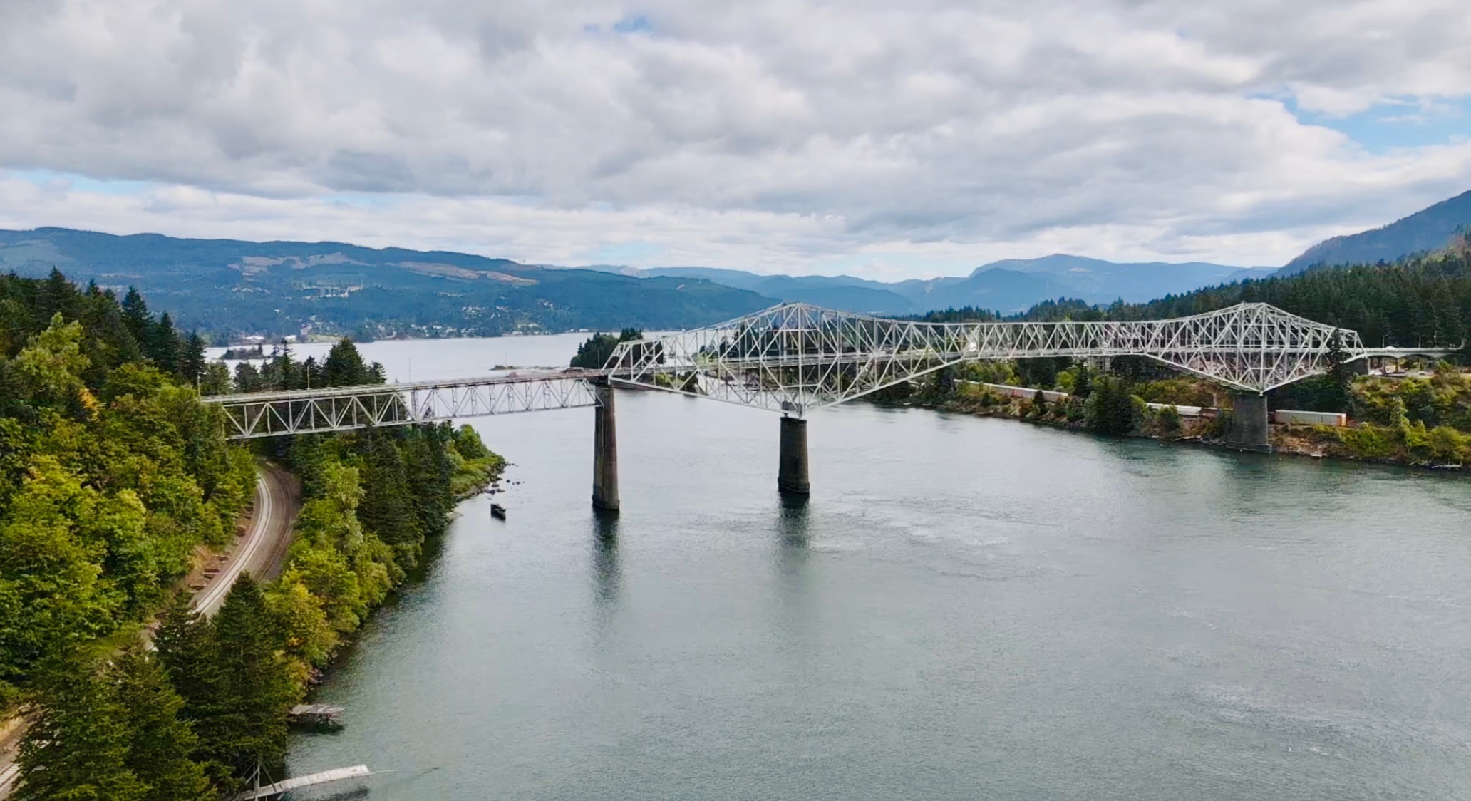
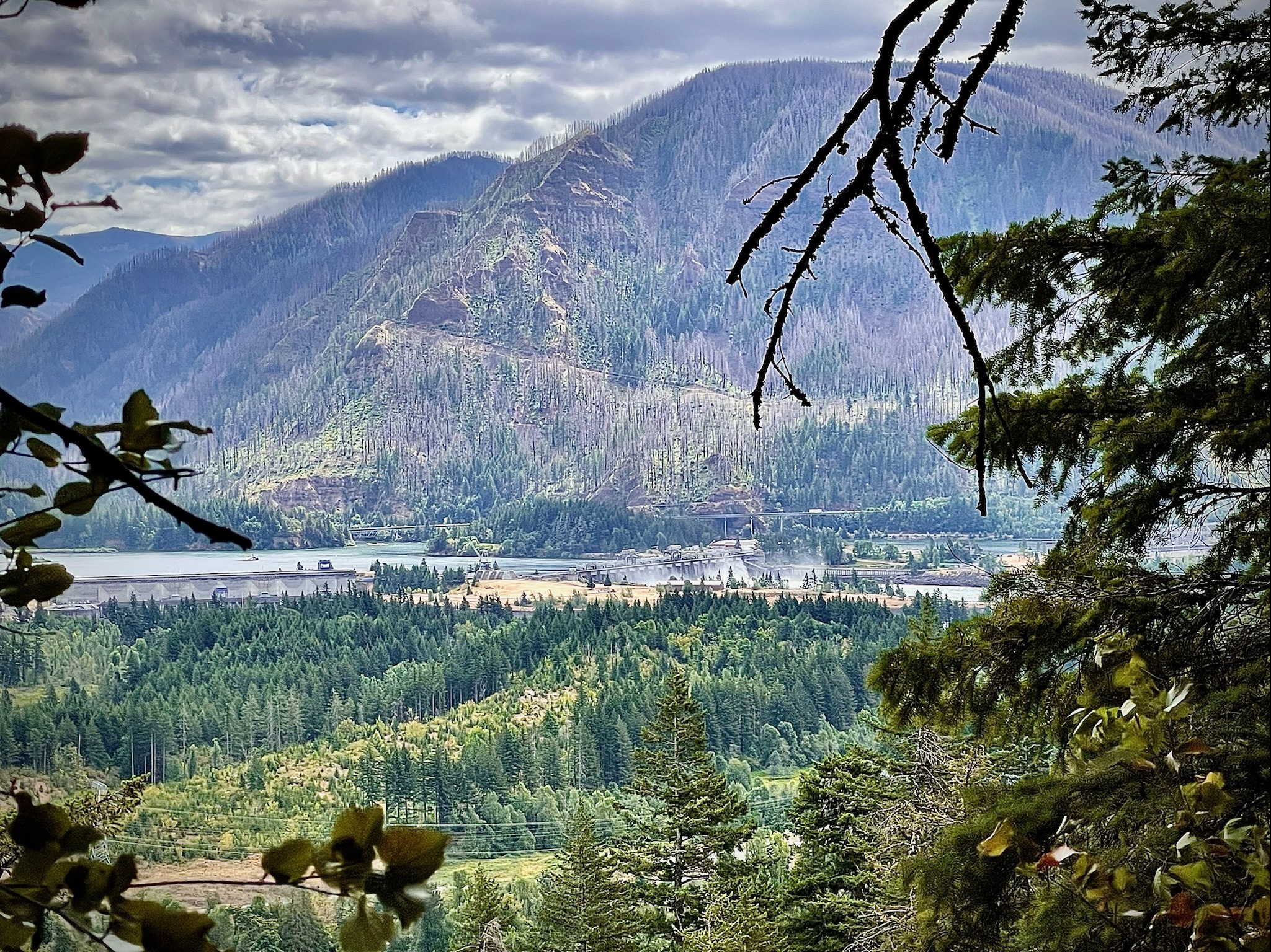
When we left the outskirts of the little town of Cascade Locks, Oregon and hiked up to the Bridge of the Gods, we were a bit overwhelmed about crossing the bridge and weren’t really sure what to do next. The bridge didn’t have a sidewalk or pedestrian bridge that we could see and with busy traffic going both ways on the super long bridge taking up the entire deck, we felt a little like deer in headlights. Rushing lines of cars, trucks, SUVs and giant 18 wheelers were headed both ways on the metal bridge that hadn’t changed much in the 100 years since it had been opened in 1926. There was no sidewalk for pedestrians to walk on and as we stopped to figure out our next steps at the vehicle toll booths, we caught sight of a sign mandating that pedestrians must walk facing traffic and to not stop on the bridge. We had been kicking around the idea of having the drone follow us in the air while we walked across the bridge but immediately we realized that was a terrible idea because it was sketchy enough just trying to survive trying not to get hit by a vehicle or being squashed by a semi-truck.
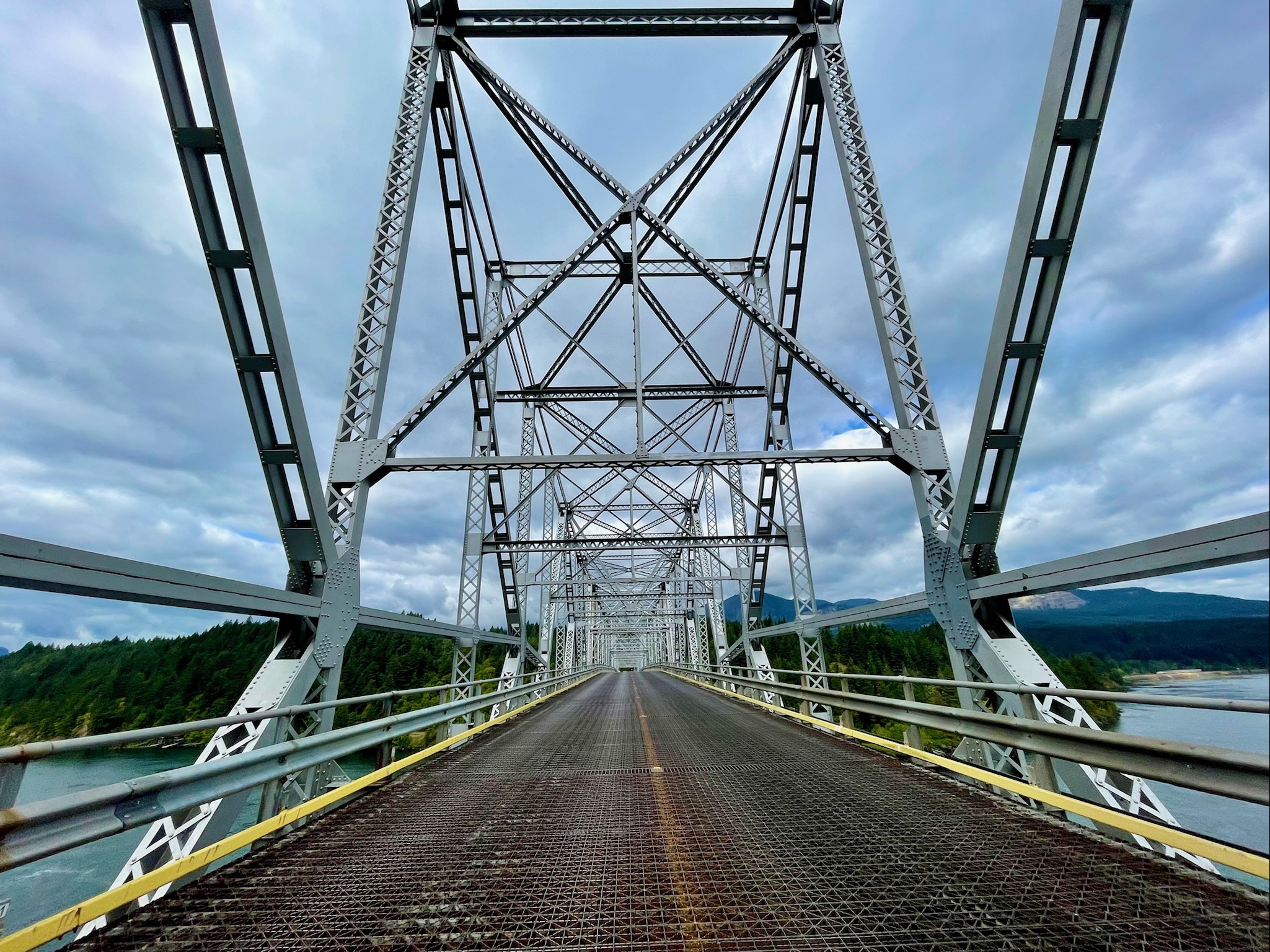
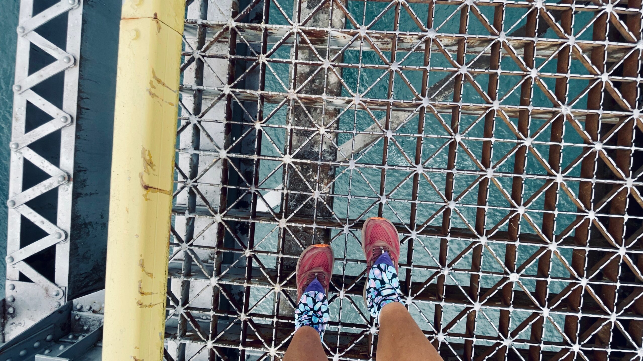
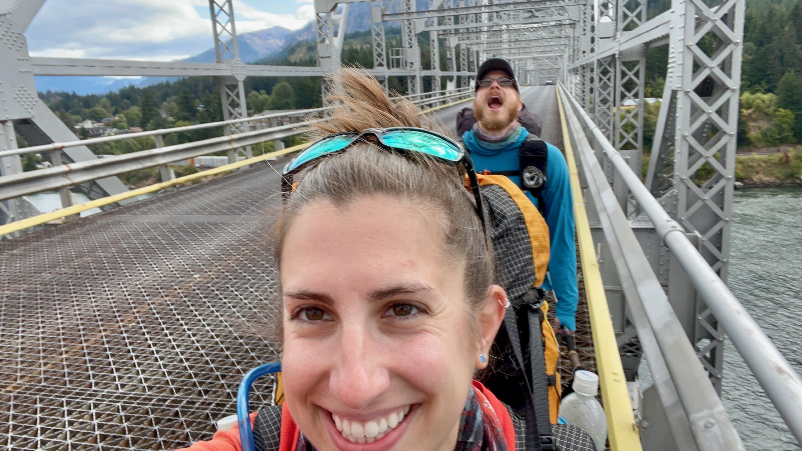
Cars roared past us, shaking the floor of the century old metal bridge as we stood nervously next to the entrance debating what to do next. I looked down at the floor of the bridge and gulped at what I saw, immediately looking away. We were standing 200 feet above the powerful Columbia River that was roaring and rushing underneath us. What we hadn’t counted on was that the entire deck of the bridge was completely see thru. No one had told us that the Bridge of the Gods had a metal grate for its surface with large gaps in the bridge decking that made your head spin and legs shake if you stared down at your feet for too long. This was going to be interesting.
Shaking off the vertigo, we swallowed our feelings of impending doom and focused on the challenge at hand – dodging cars and trucks while trying not to pass out from vertigo. It was a real life game of Frogger, PCT style. We tried to make eye contact with the toll booth collectors and the oncoming vehicles to stop traffic for a second so we could cross the road but no one stopped. So we trekked purposefully across the bridge and hugged the left side of the decking, trying not to look down at the cold depths of the river below and focusing all of our attention at the oncoming traffic. Cars and trucks filled up the traffic lanes on both sides of the road at several points, forcing us to quickly jump up onto a metal beam and tightly grab the railing holding on for our lives. If you didn’t think thin with your big backpack on while balancing on something the width of a gymnastics balance beam perched over a 200 foot sheer drop, you were going to get squished and certainly go meet the gods who made this not-so-pedestrian-friendly bridge. The scariest part of the 5 minute trek was when a giant 18-wheeler truck barreled towards us from Washington while another semi approached from the Oregon side, crossing paths right at the point we were walking at on the bridge. There was absolutely no room to remain on the decking so we white-knuckled the bridge railing as we shimmied our backpacks over the railing and held on for our lives as the enormous vehicles passed. It was just a little bit nerve-racking but we didn’t get run over or fall to our deaths so life was good. Later we found out the famous aviator Charles Lindbergh once flew his plane The Spirit of St. Louis under this same bridge in a publicity stunt – that’s how high up we were!
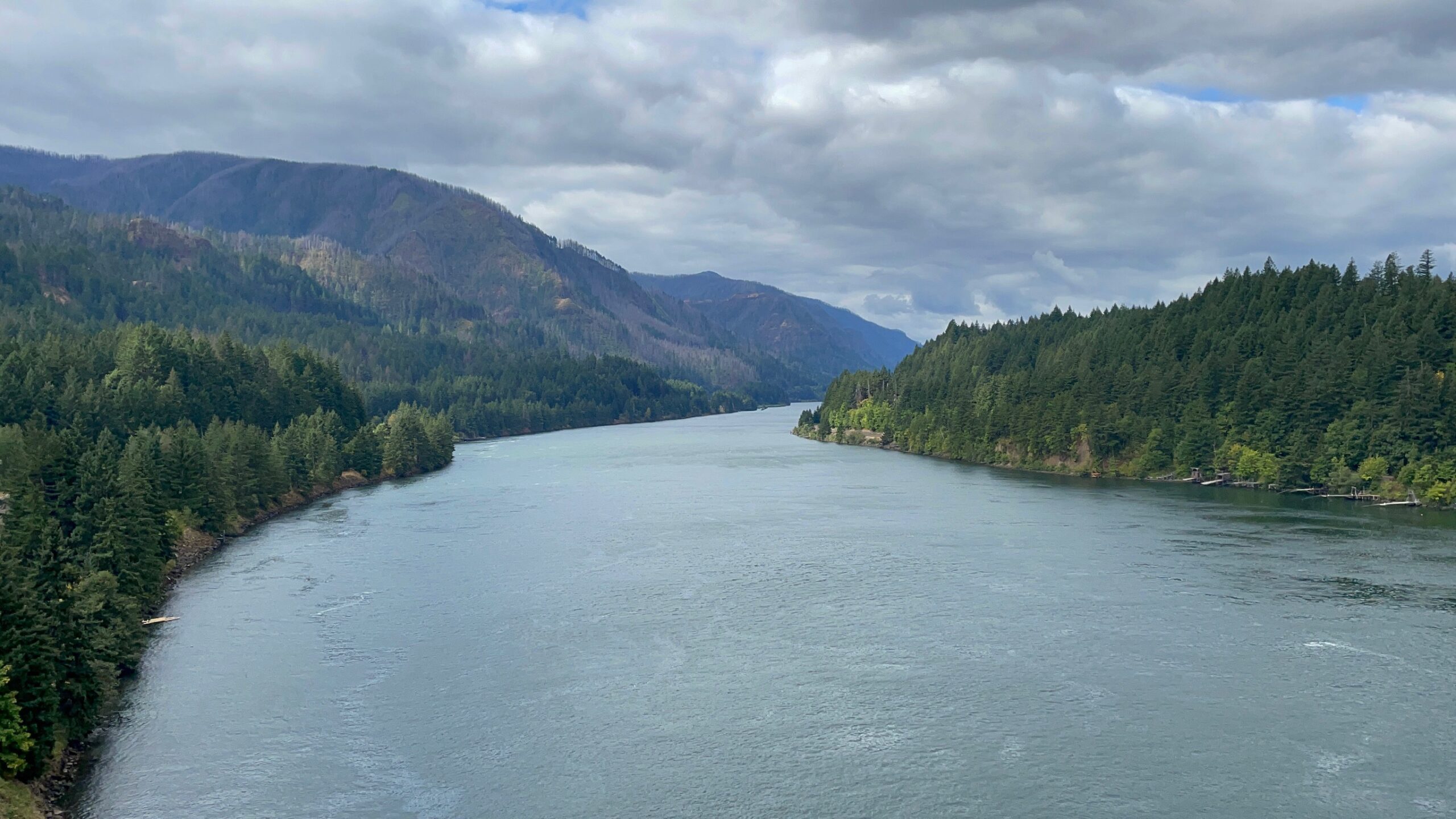
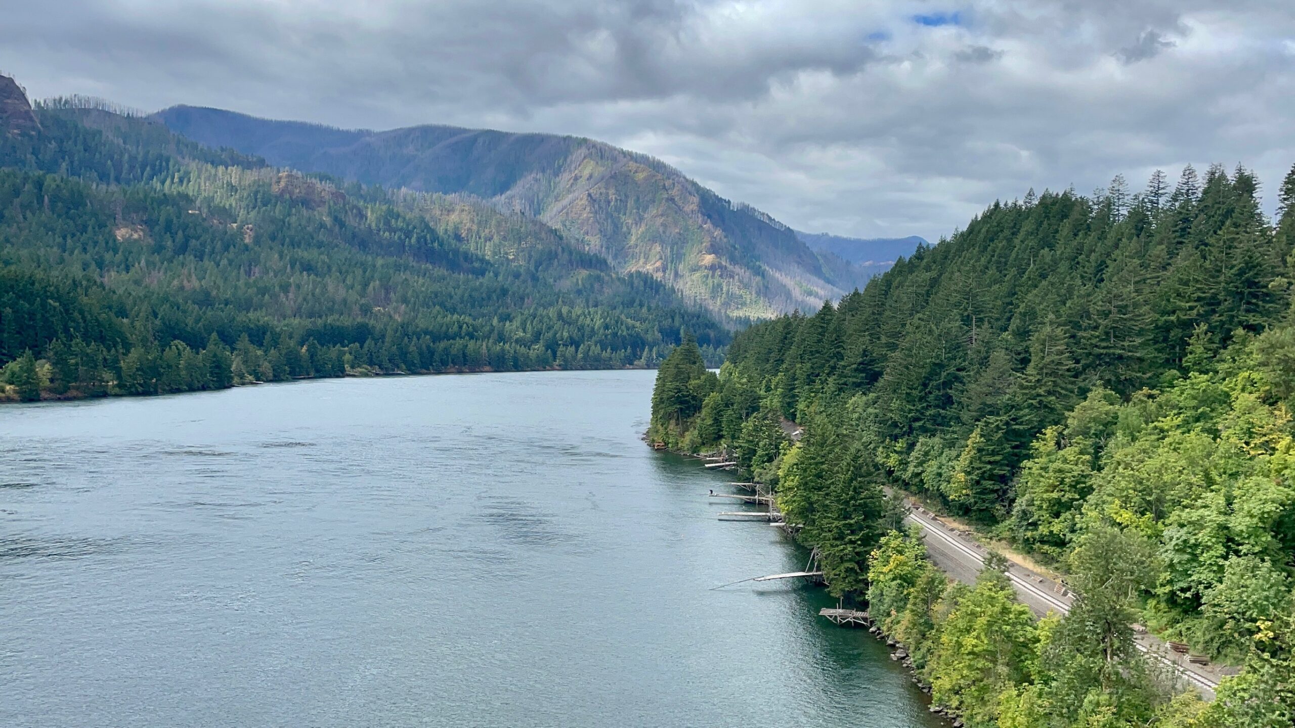
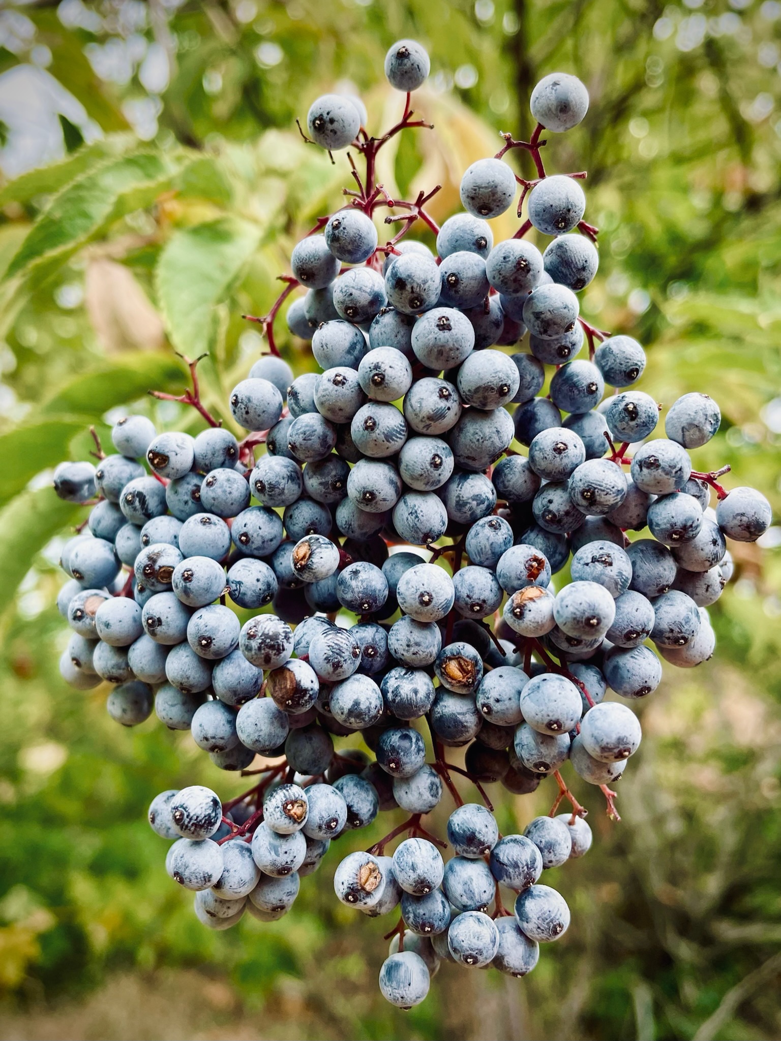
At the far side of the Bridge of the Gods, we celebrated not dying and also crossing into the state of Washington with a little dance and chowing down on some blackberries. Woohoo! Shannon and I left the trail momentarily, trekking down a steep dirt road to the train tracks where we flew the drone for a little bit, grabbing some video footage of the giant bridge. We watched a guy fishing off one of the daredevil homemade fishing piers that stuck out into the river which looked like they were nothing more than a few planks of woods strung out over the depths. It was so amazing to see the fisherman haul flailing silvery salmon out of the currents and easily fill an entire wheelbarrow with only a few of the monster fish. Being close to peak salmon run season, it didn’t take him but 10 or so minutes before he hauled three enormous salmon out of the water and wheeled them to his truck’s cooler. Since the salmon are on the way to their spawning grounds of the shallow tributaries and offshoots of the Columbia River, some of them are colored red and black to attract mates whereas others are silver. By now the salmon have not only traveled across the vast Pacific Ocean from their feeding grounds but have swam over 100 miles against the currents of the Columbia River to get to this point. We congratulated the fisherman on his haul of 2 silver and 1 red colored salmon and then headed back up to the PCT.
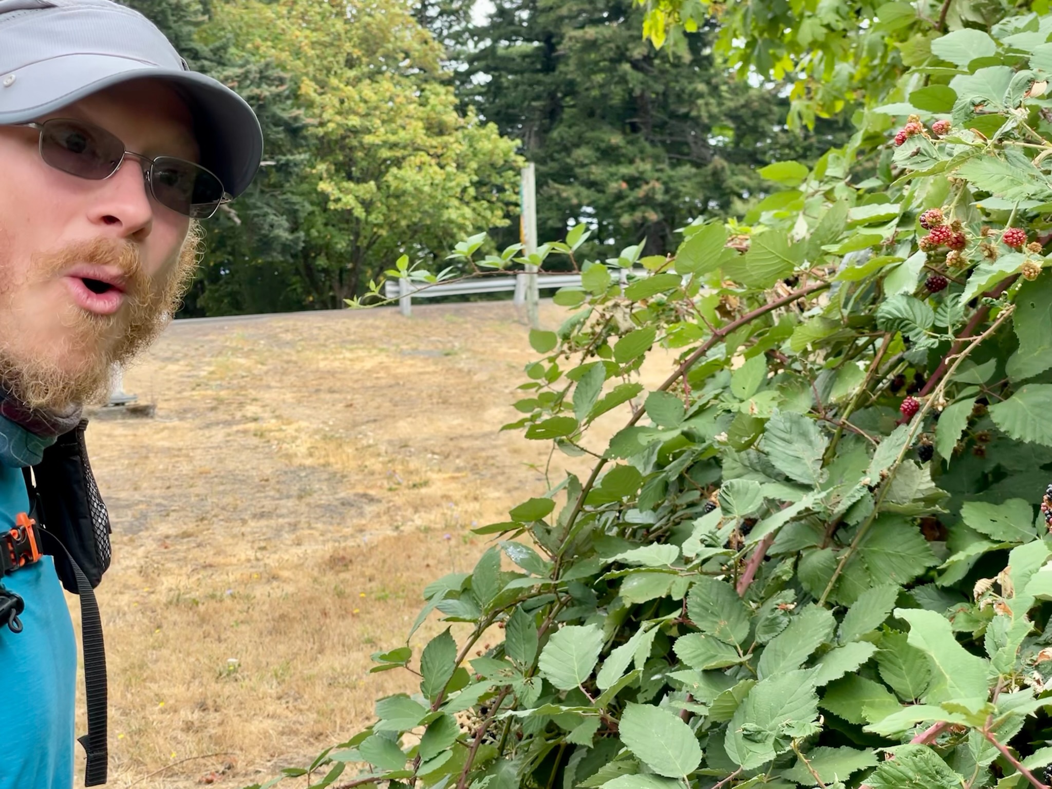
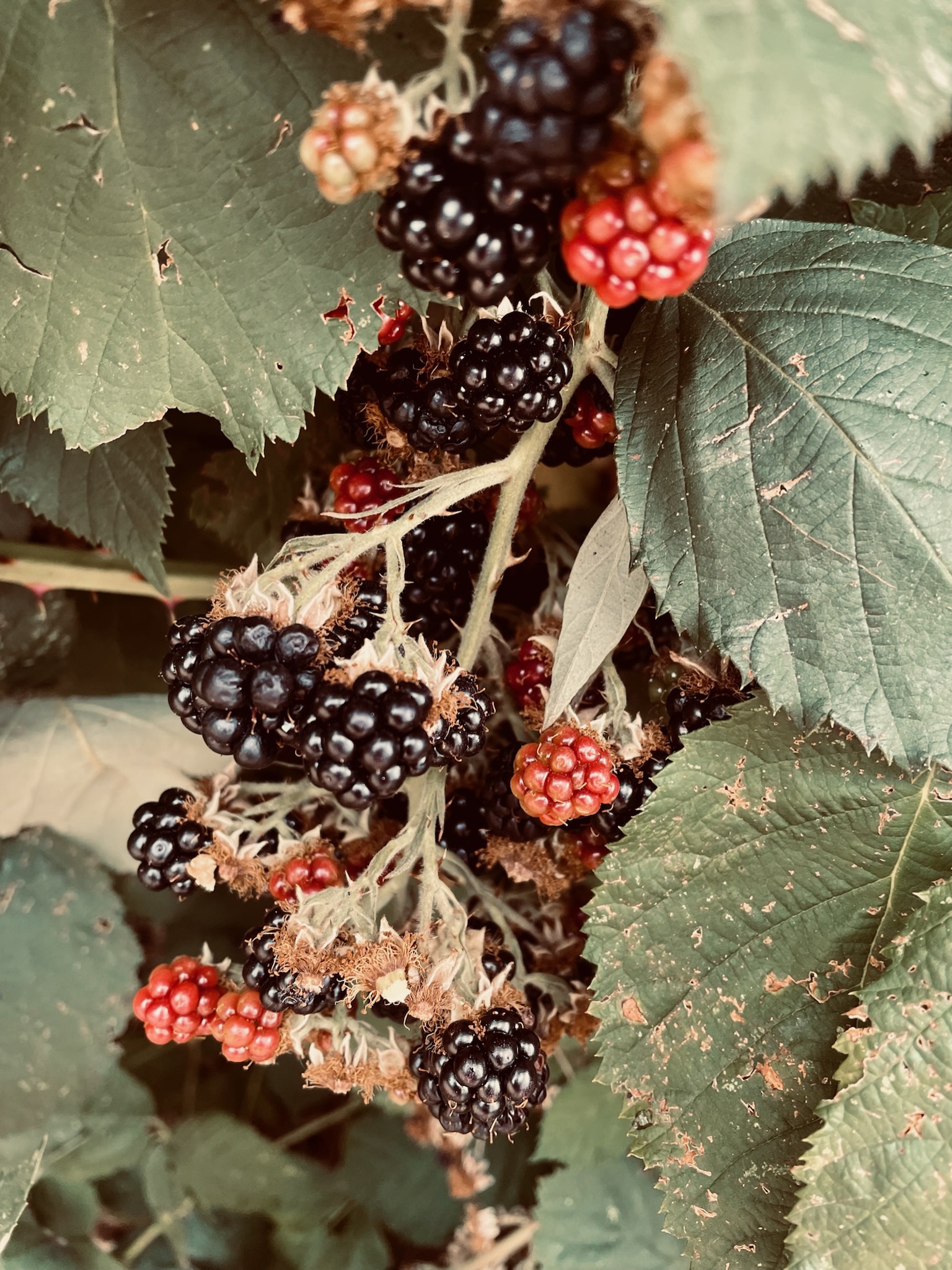
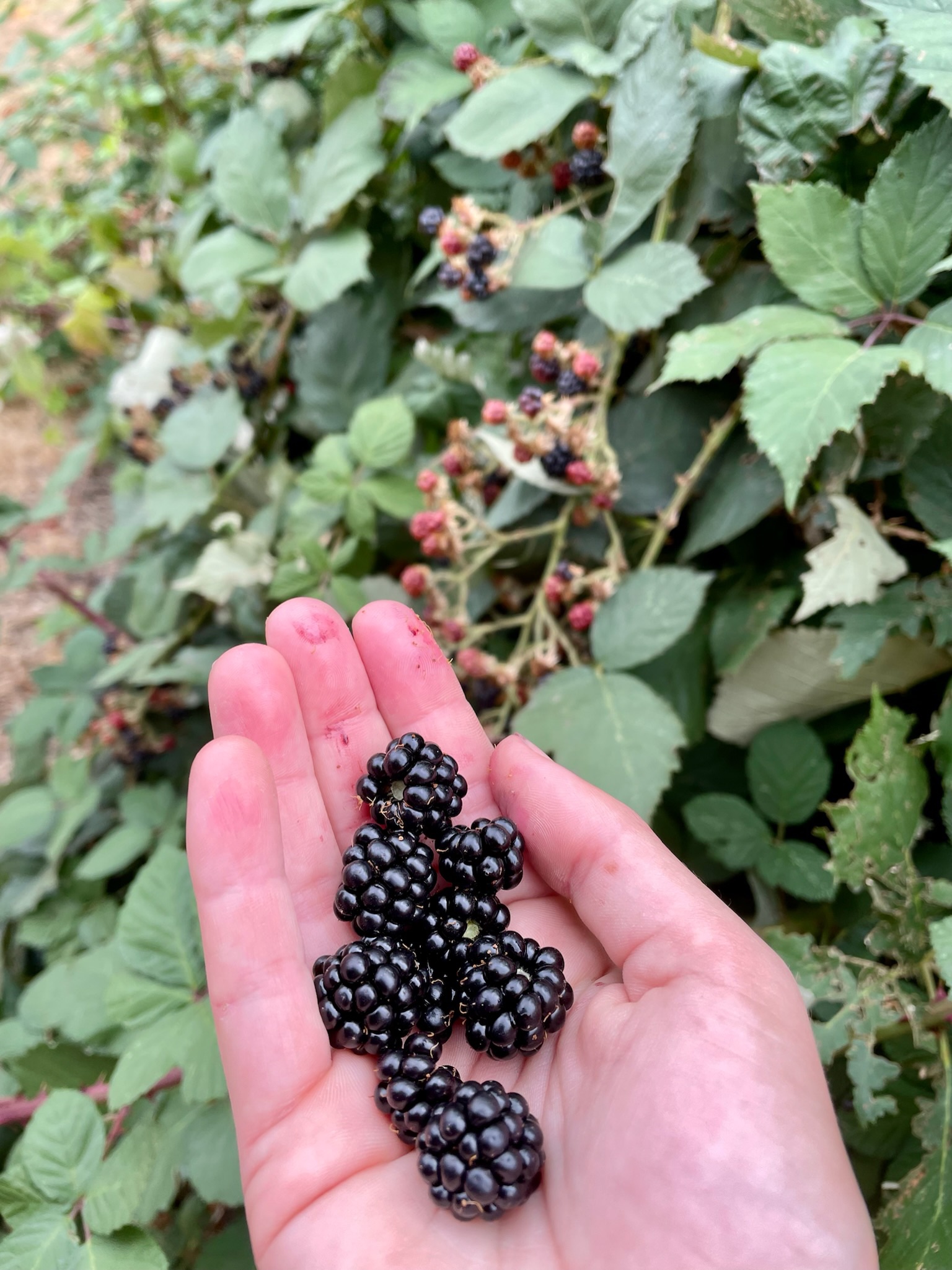
Back on the side of the road, we picked some more blackberries which were a great way to relieve our stress from crossing the Bridge of the Gods. Shannon and I dove into the bushes, emotionally eating handfuls of juicy dark violet gems tangled up in briars. The deep purple juice mixed in with the streaks of red scratches from getting too close to the thorns and we realized that the miles weren’t going to hike themselves so we better get going. As we hiked off the road and back into the woods, we watched a local couple who had also spied the enormous blackberry patches from their car and hopped out of their truck to collect the blackberries in a big bucket. It was good to see people taking advantage of the bounties that were around them and eating local!
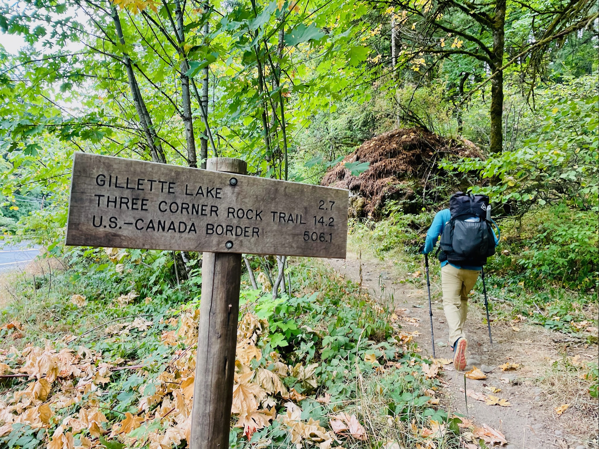
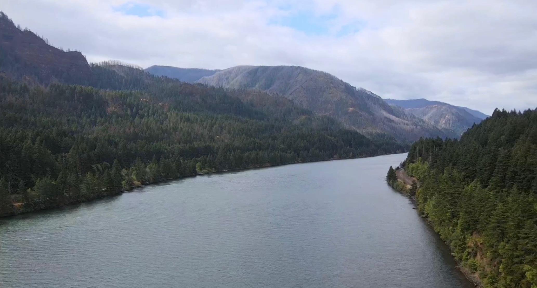
Shannon and I hiked on from civilization, the noises of the road slowly disappearing behind us as we were swallowed up by the dense forest. We trekked up from the lowest part on the entire PCT at the Bridge of the Gods 2,100 feet above sea level to ascend into the mountains of southern Washington. Fueled by blackberries, we sprinted up the hills and spent the late morning passing about a dozen PCT hikers before stopping to quickly eat lunch. There wasn’t a lot to look at in the woods and so we hauled butt, briefly pausing to chow down at a little campsite next to a creek where we met fellow hiker Pac-Man from Los Angeles. We met a bunch of his Trail Family such as Pothole and about 4 or 5 others who’d been hiking together since Southern California 2,000 miles ago. They were super nice and it was crazy to see these Trail Families, or Tramilies, still sticking together months later.
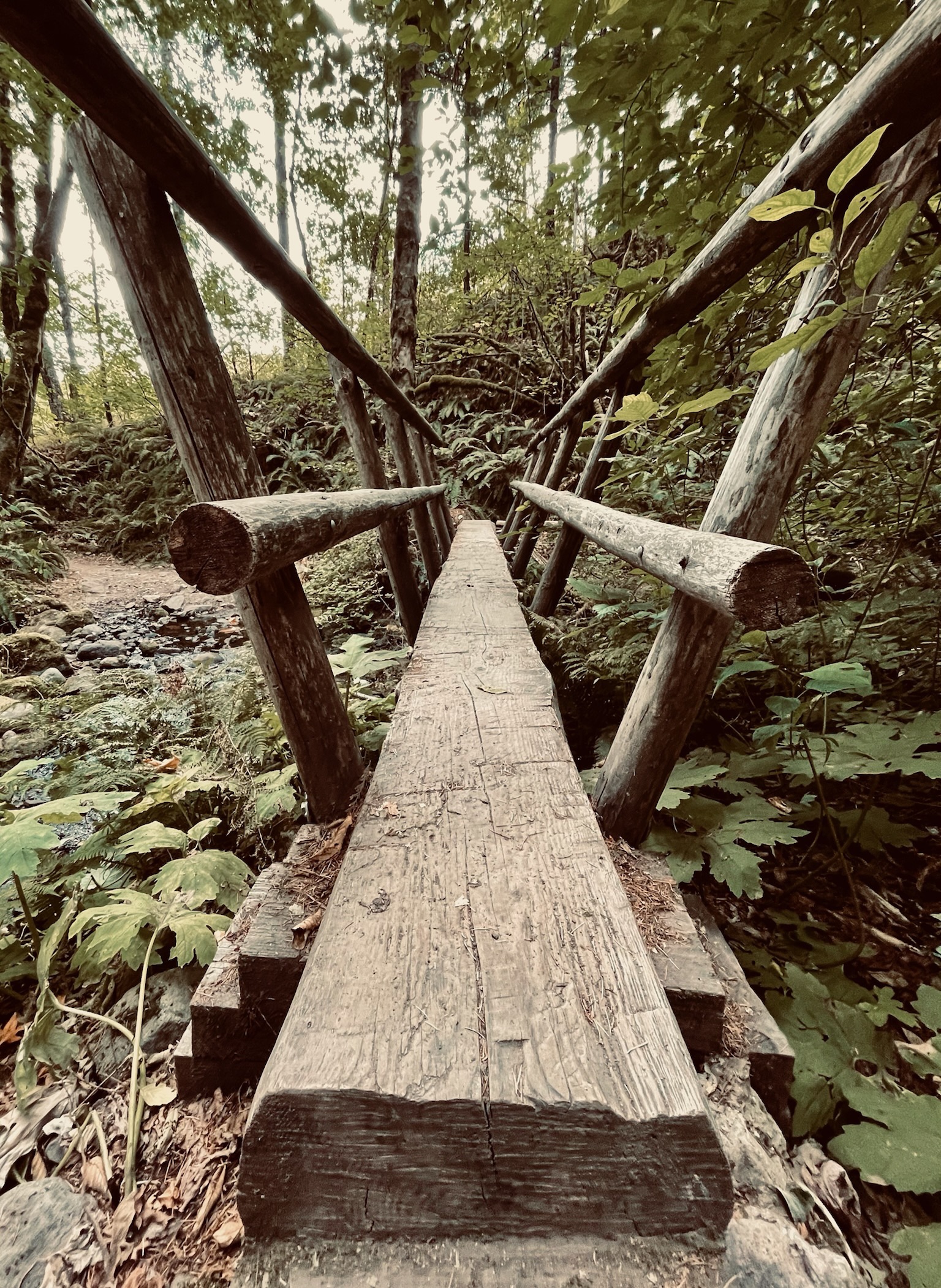
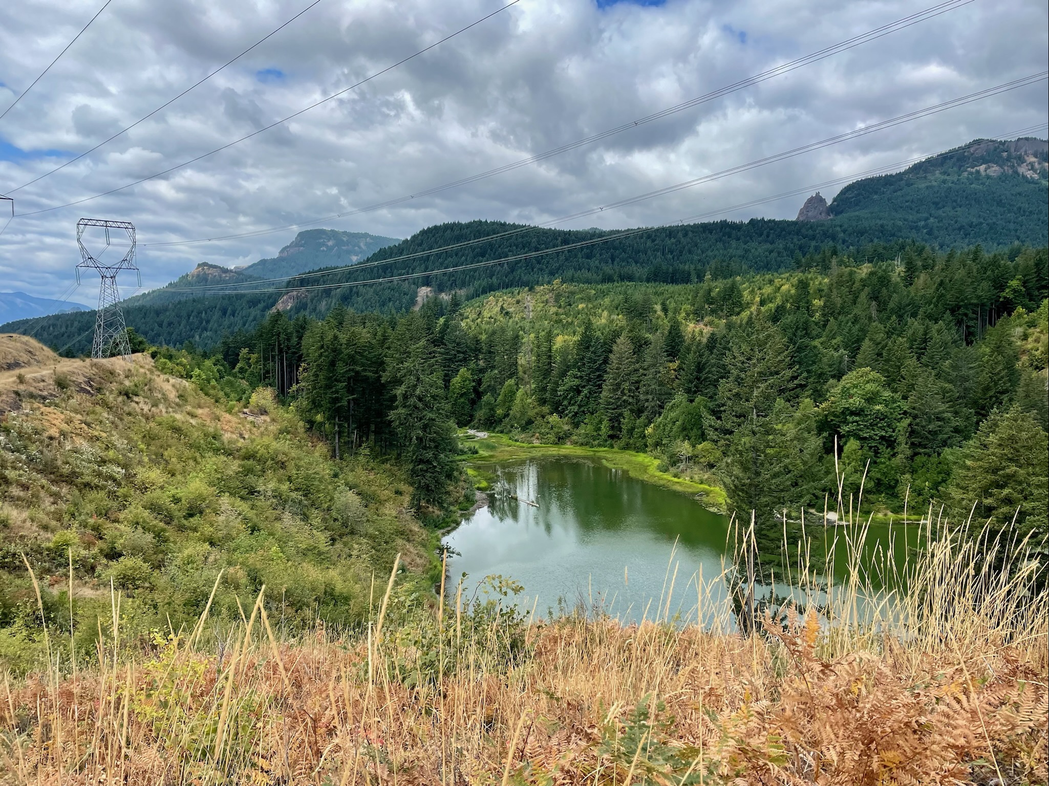
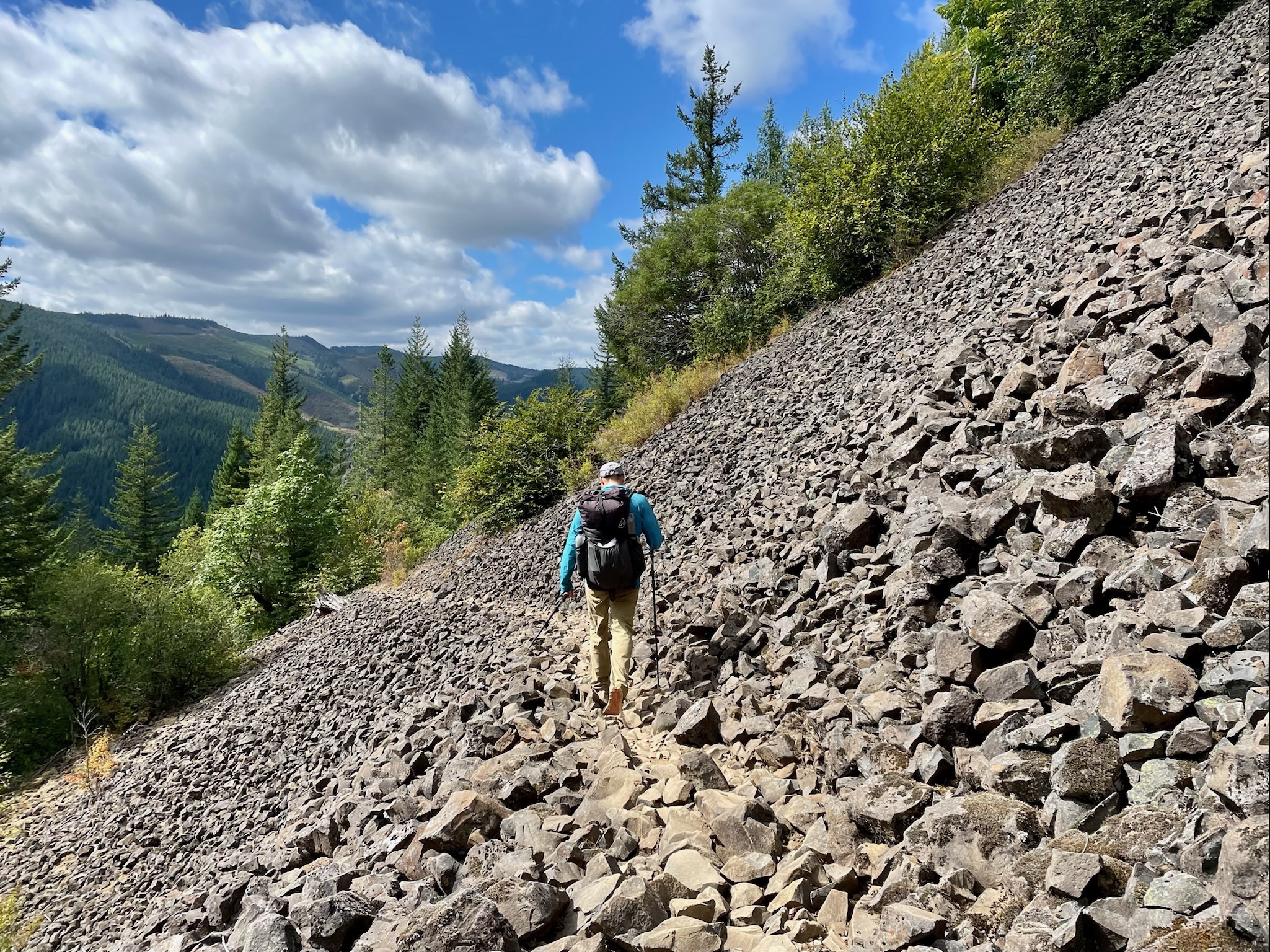
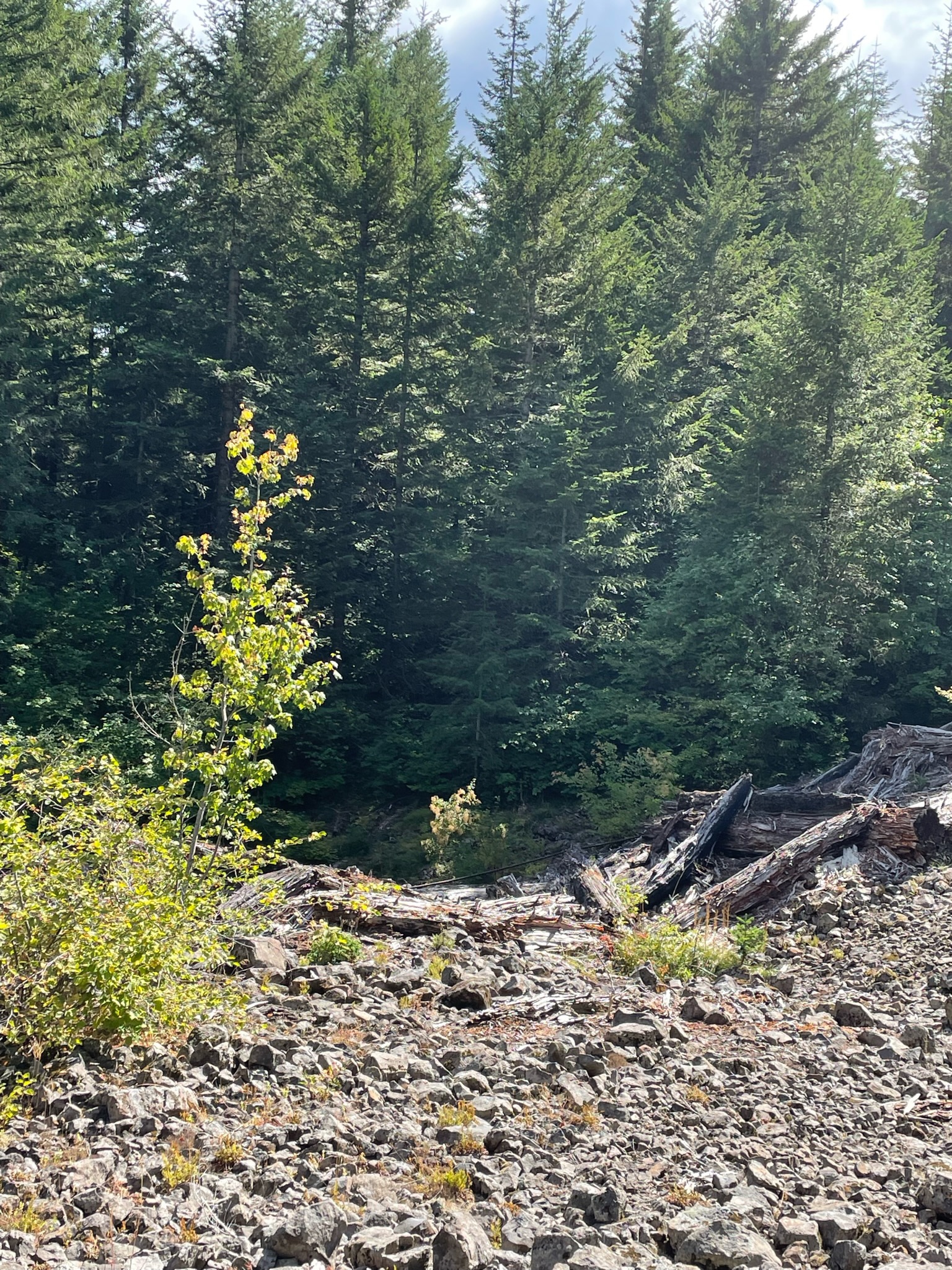
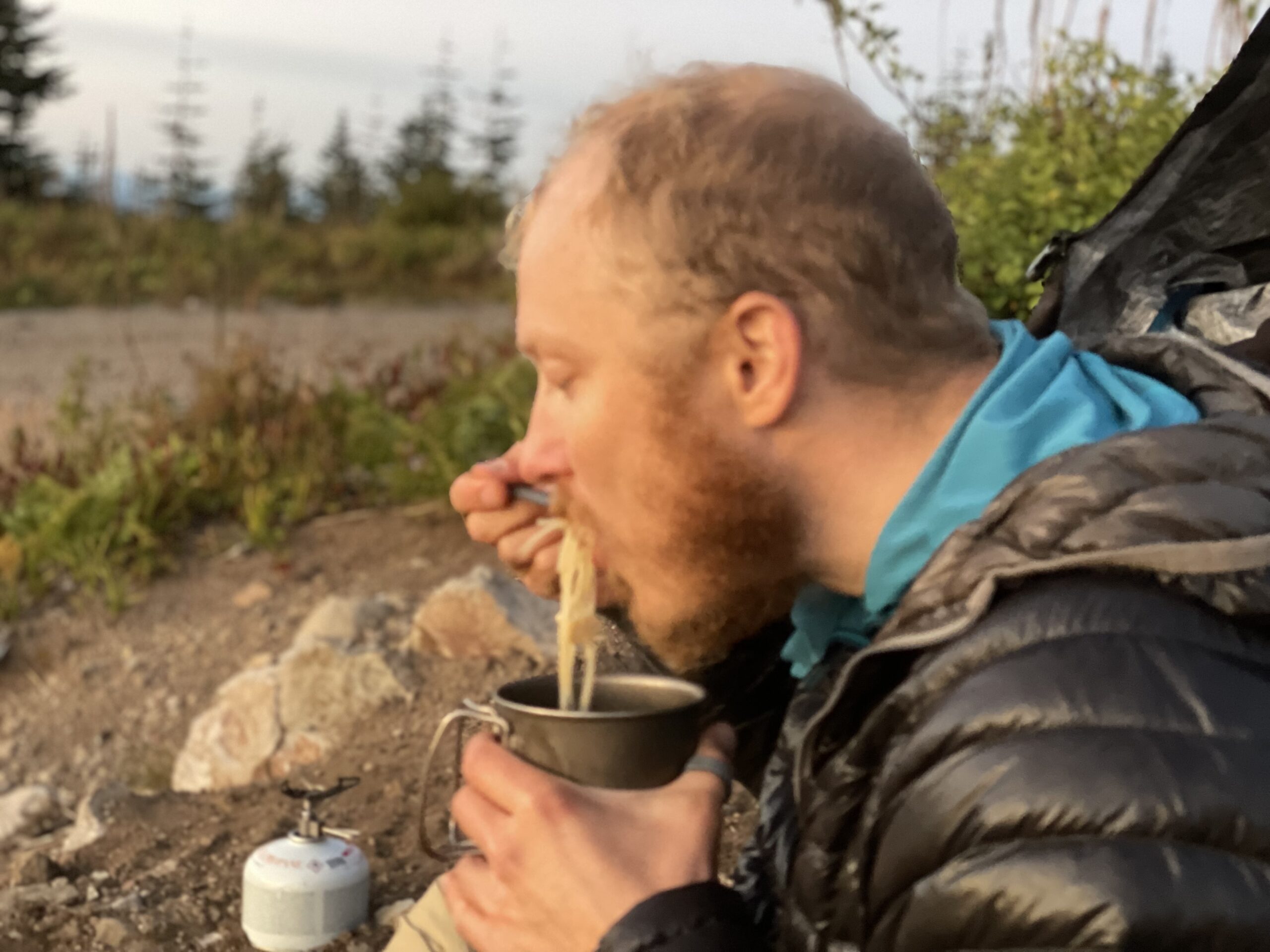
Shannon and I topped off our water at a small creek and then hiked on the next 11 miles of trail which was surprisingly a completely waterless section. You would think Washington with all its fog and rain that there would be water everywhere but I guess not! We would have to be wary of our water supply and not get lazy like in the Sierras where there was so much water it wasn’t even funny. Up, up and up we went into the mountains, the trail becoming progressively rockier and rougher as we trekked up into volcanic forests.
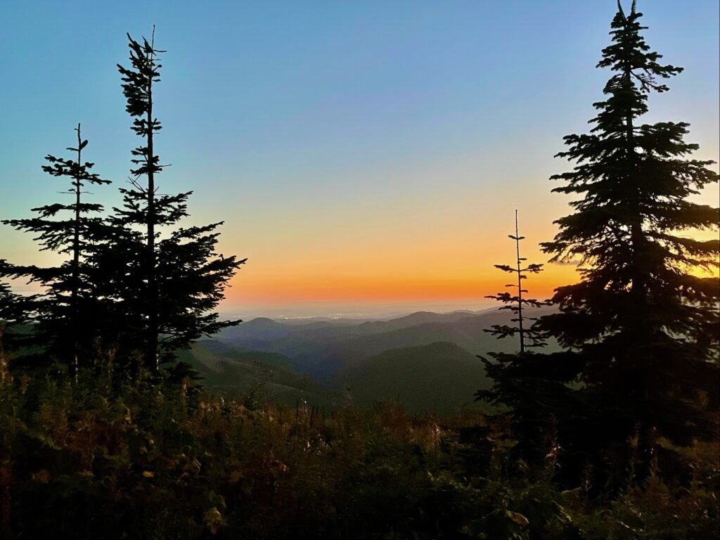
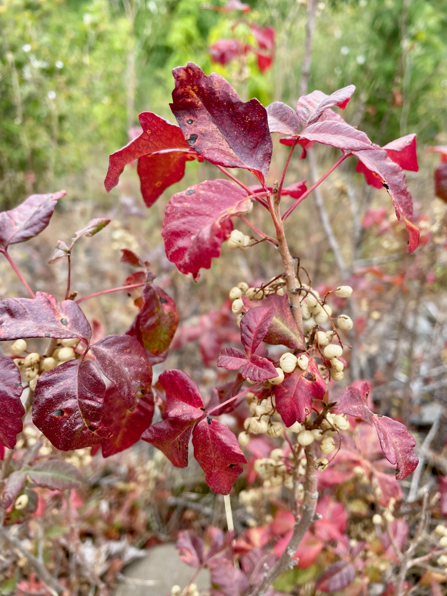
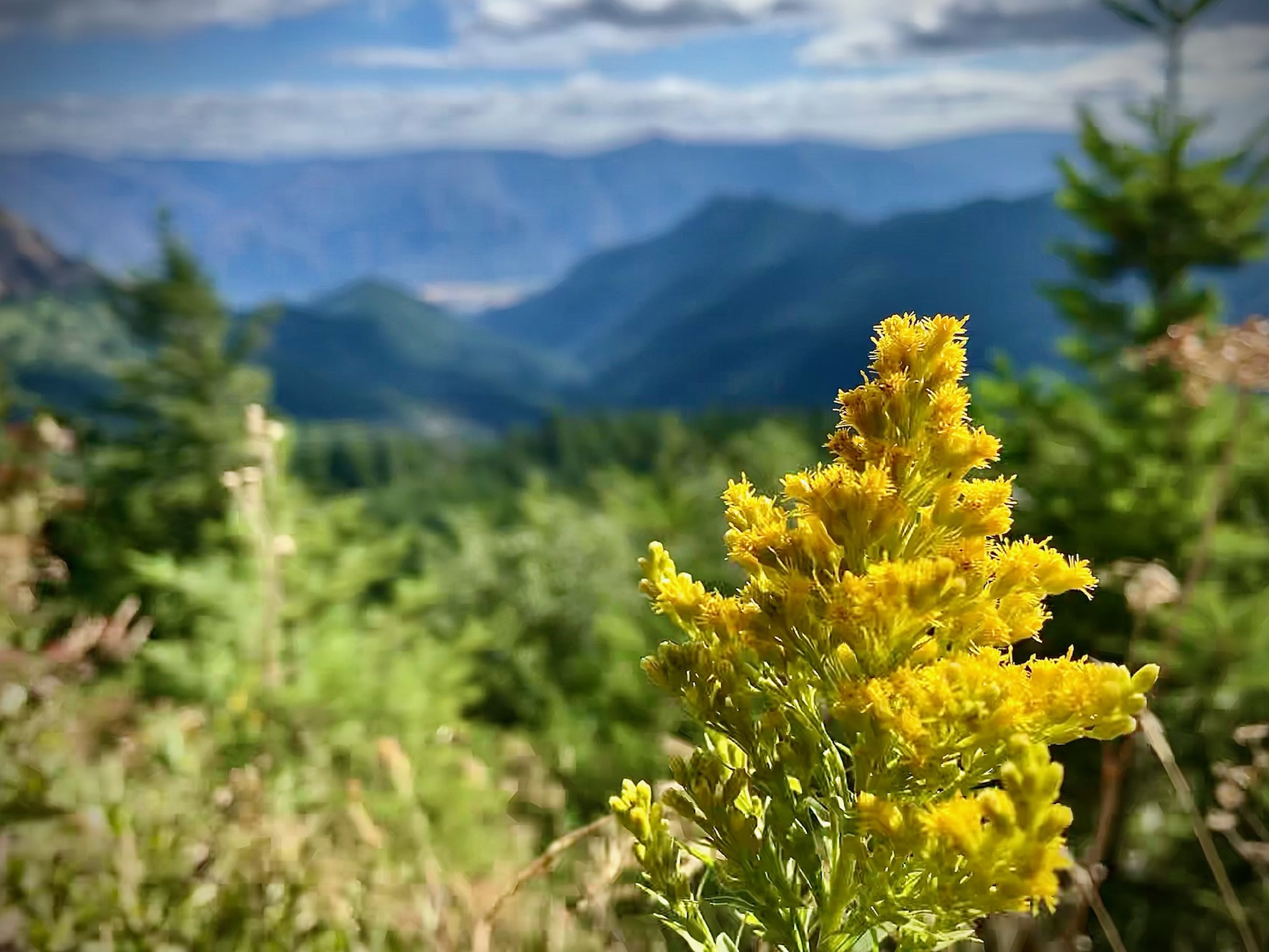
The PCT passed some old train tracks in the middle of the woods which despite looking completely busted, rotted and swallowed up by trees were historically important. We heard from other hikers that the failure of this railroad project in the late 1920s caused a butterfly effect that triggered several smaller railroad companies to default on their loans leading up to events contributing to the Great Depression of 1929. Pondering the ruins of the railroad, we continued on, stopping at a saddle with some of the first views we’d seen since Bridge of the Gods. Haha here I am complaining about the lack of views on one of the most view-heavy trails I’ve ever been on! The day was clear, the mountains had no fog to be seen and it was great to be able to relax in the sunshine, leave the shaded trees and have a nice view for a minute. In the small fields near the saddle we snacked on some Serviceberries (aka Juneberries or Saskatoonberries) that were dried up from the sunshine and some dried up alpine blueberries.
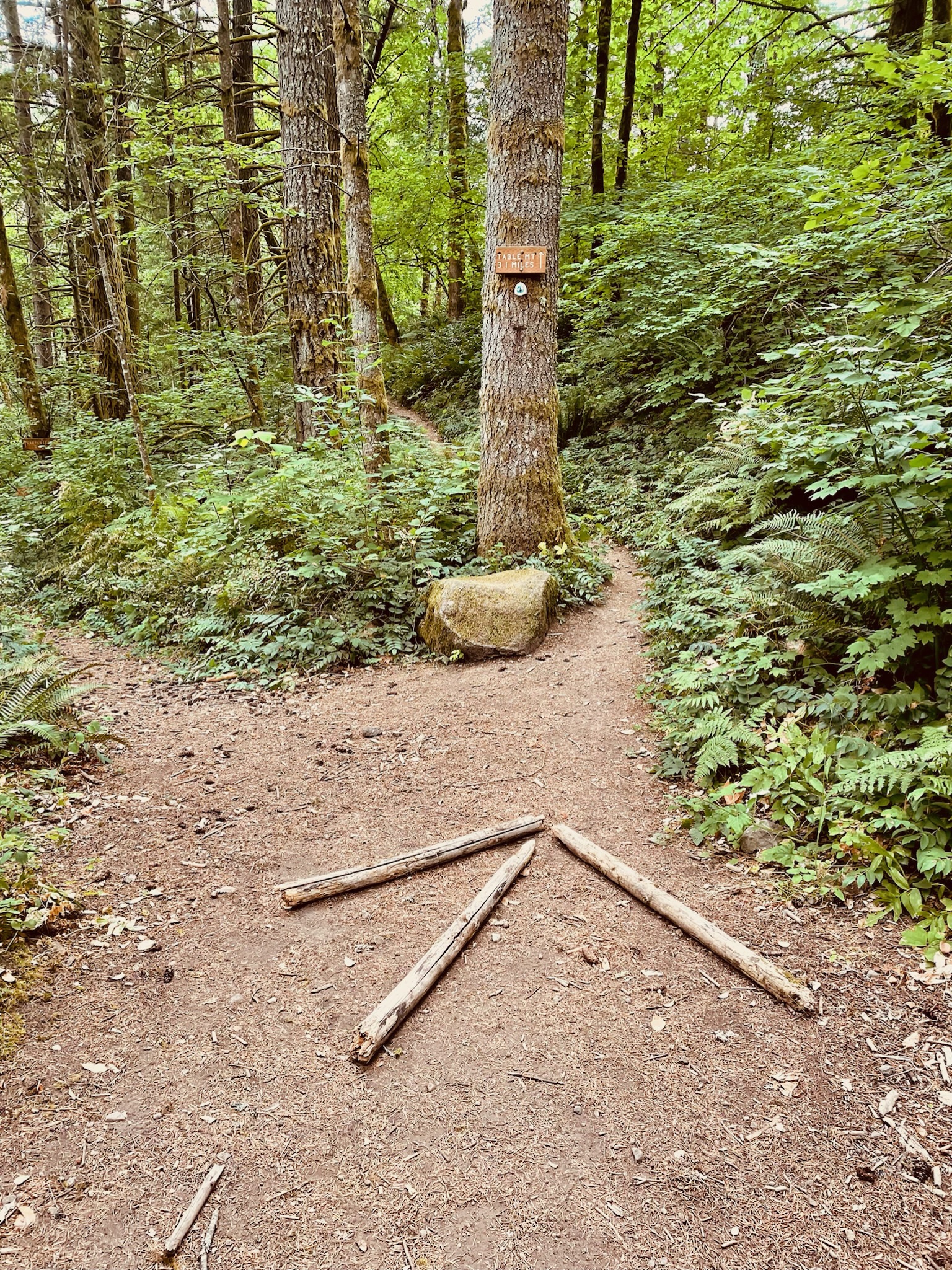
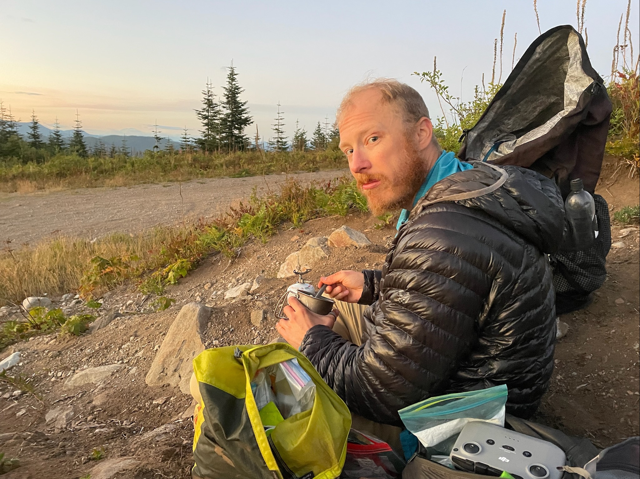
We really wanted to camp at this epic place that we’d heard about a little off trail called Three Corner Rocks. The little pinnacle has a 360° view of the surrounding mountains such as Mount Hood in Oregon, glacier-clad Mount Rainier in Washington and the famous volcano Mount St. Helens that had exploded in 1980 and impacted the entire United States. However, since this section of trail was pretty dry, we weren’t sure if we had enough water to stay overnight up at the peak since the spring had been dry since 2017. We cut off trail to follow a gravel road where our map showed that there was potentially some water. Unfortunately the whole area was dried up like cement and there was no water to be found. I found out that the ground was rock hard from trying to dig a cat hole to take care of some business and almost broke my shovel. Not fun times.
After reviewing the topo maps and trying to figure out how to get back to the Pacific Crest Trail, we briefly paralleled the PCT trekking up an old forest road and some snowmobile trails through fields of dense brush and tall grass where I started to get some mountain lion vibes. Luckily out in this remote section of trail any large feline predators in the area left us alone and we weren’t anyone’s kitty chow for dinner! We passed by large stumps where logging or wildfires had stunted the forest and then through new growth pines and hardwood saplings where the woodland had started to be reborn after tragedy. Thick swaths of hardy pine saplings intermingled with tangles of huckleberry bushes and dense bouquets of wildflowers next to the rocky trail. We veered off onto a packed mud trail, the hard dirt track preserving old deer tracks and dried coyote or mountain lion poop everywhere. My head was definitely on a swivel here but it felt reassuring that the twisted fur filled droppings were pretty ancient.
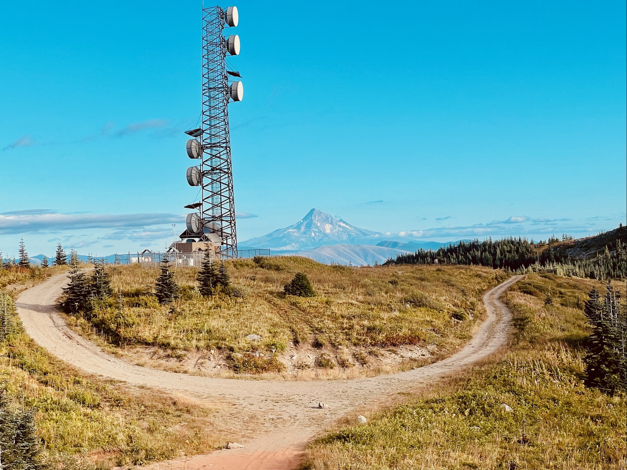
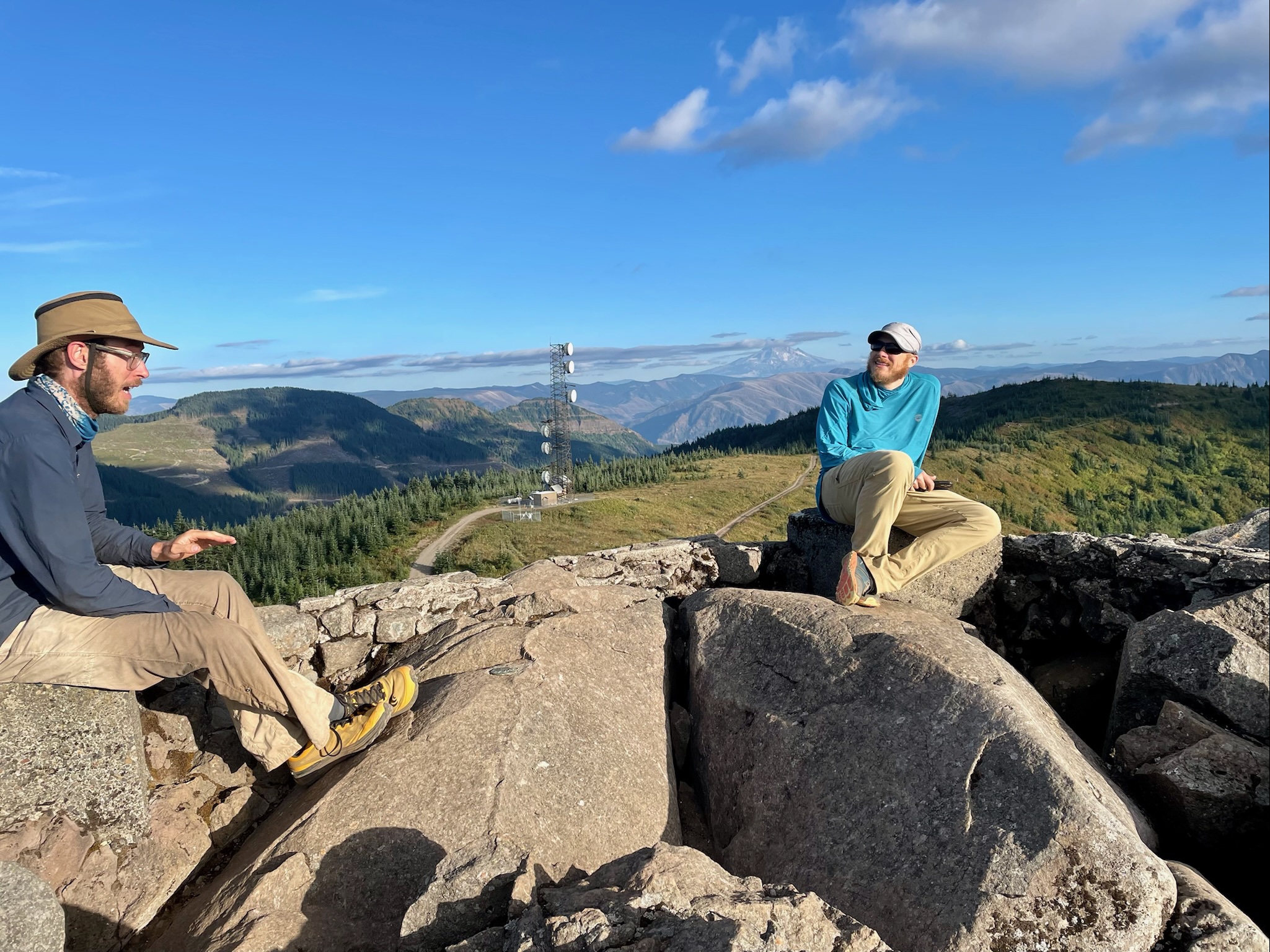
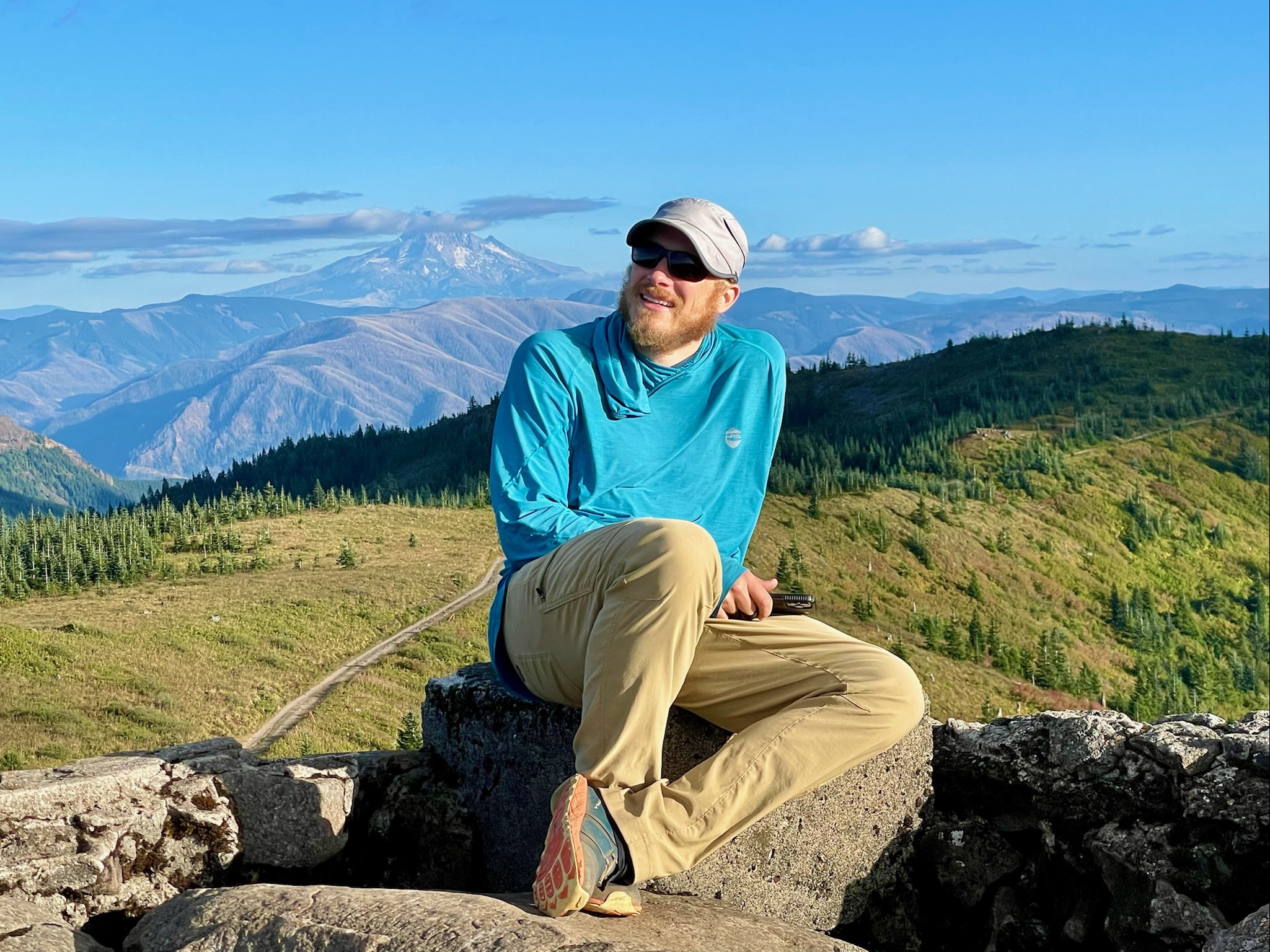
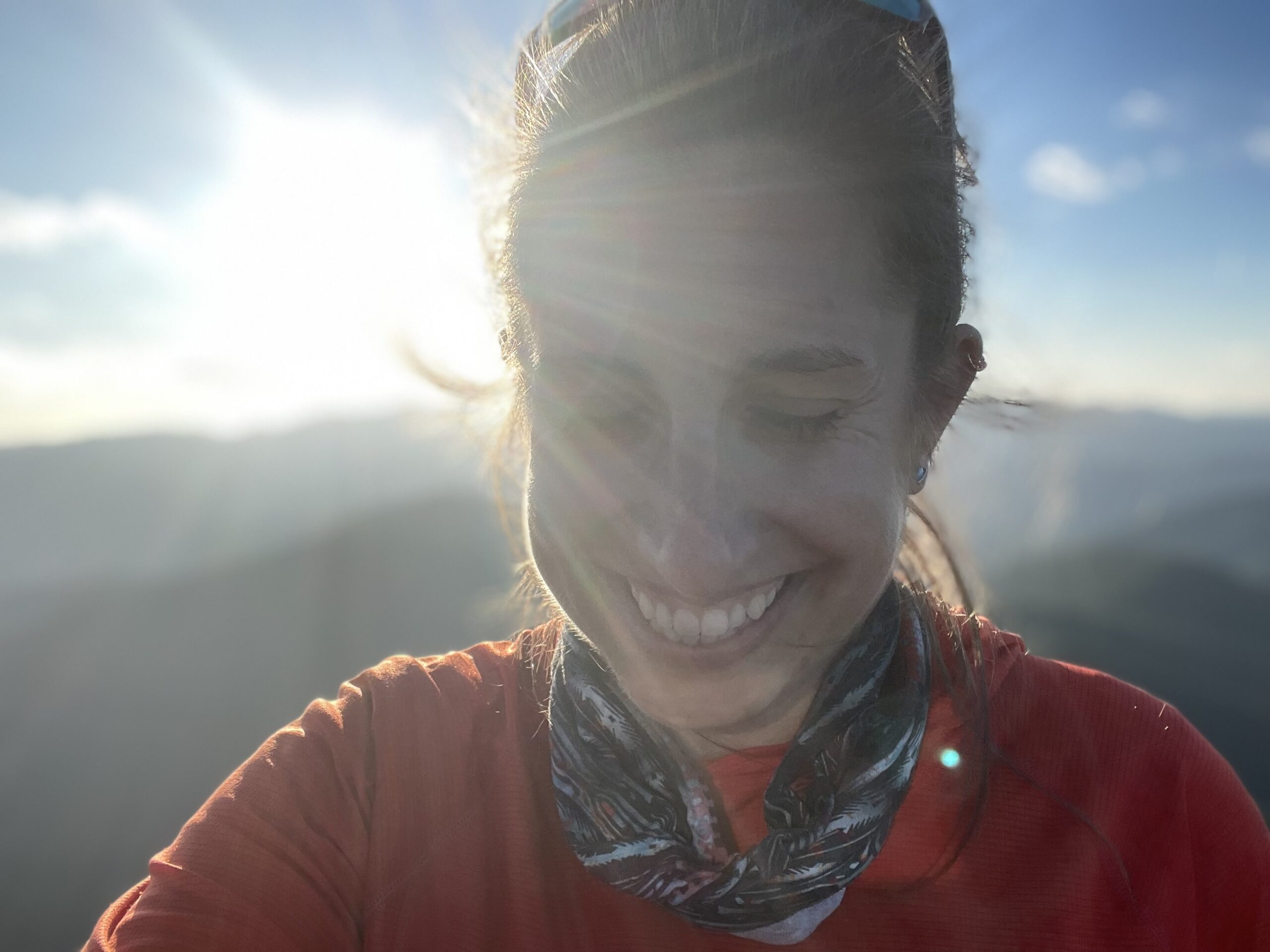
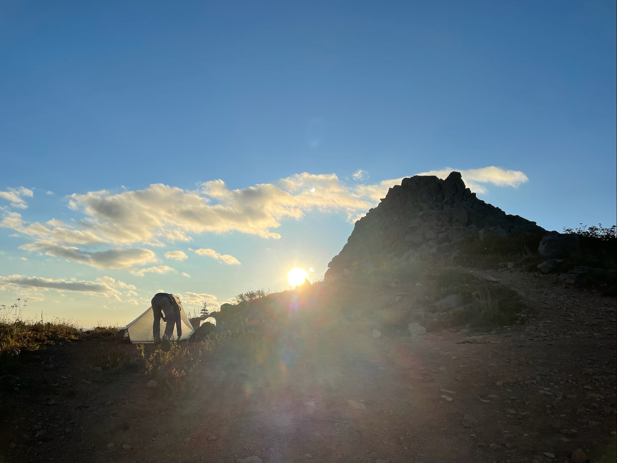
A red clay trail wound its way up to the top of Three Corner Rock and spit us out of the dense forest into a huge meadow where a radio tower stood by its lonesome to our left and a rocky pinnacle on our right. Perched atop the summit we saw someone sitting on top of the stack of rocks with the late afternoon sunlight highlighting their outline. We dropped our bags at a flat spot of dirt and scrambled up a steep boulder climb where we joined fellow PCT hiker Mr. Wobbles at the top of Three Corner Rock. Mr. Wobbles was a southbound hiker who got his name from hurting his knees the first day he was on the trail and had a great sense of humor.
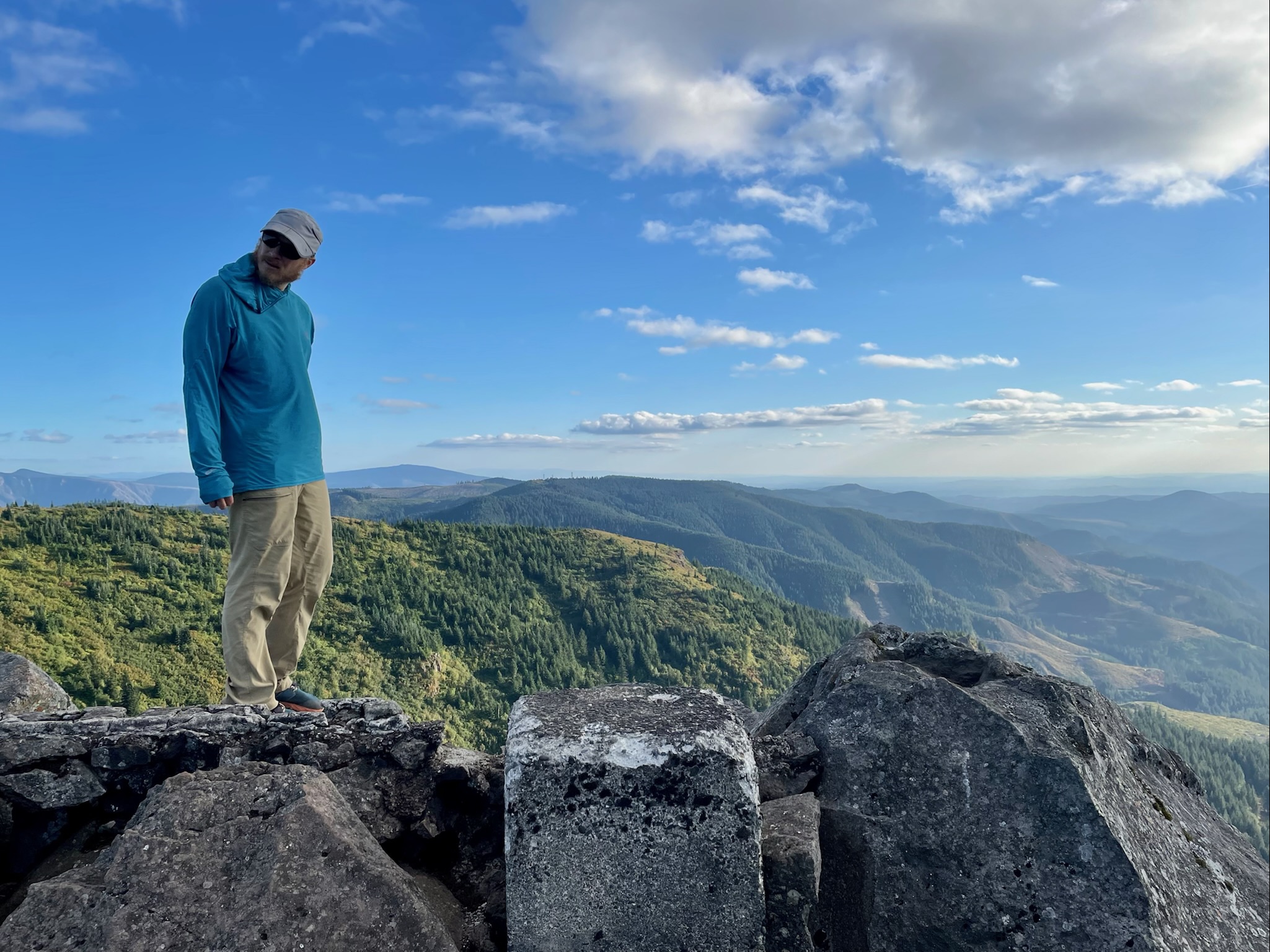
At the summit we found an old concrete foundation from a long gone fire tower that was slowly wearing away under the sun, wind, rain and snow. Shannon and I shimmied carefully over the boulders and settled in on the weathered cement walls to admire the beauty around us. Our new friend Mr. Wobbles pointed out all around us the different mountains we could see in the distance, the clear skies allowing us to observe the volcanic peaks surrounding us. 30 miles south as the crow flies, we could see all the way back to snow-clad flanks of Mount Hood in Oregon, the tall summit punching a rocky fist up into the sky. Off in the distance to the northeast about 40 miles, the stately glacier-covered peak of Mount Adams rose out of the low lying woods like a sentinel guarding the state of Washington. About 30 miles northwest a ring of clouds surrounding the summit of the deadly volcano Mount St. Helens faded and the flat-topped peak was exposed as the clouds melted away. It was insane to actually be able to see this infamous mountain that I’d been fascinated with since I was a little kid. Mount St. Helens erupted in 1980, killing about 57 people and thousands of animals and the volcano shot an enormous amount of volcanic rock and ash 80,000 feet into the atmosphere which fell and created hundreds of square miles of wasteland where vibrant forests once thrived. Today there was only low lying fog to be seen and thankfully no volcanic activity coming from the caldera. It was still really cool to see Mount St. Helens from such a distance and we hoped that the closer we hiked to the volcano that it continued to remain dormant!
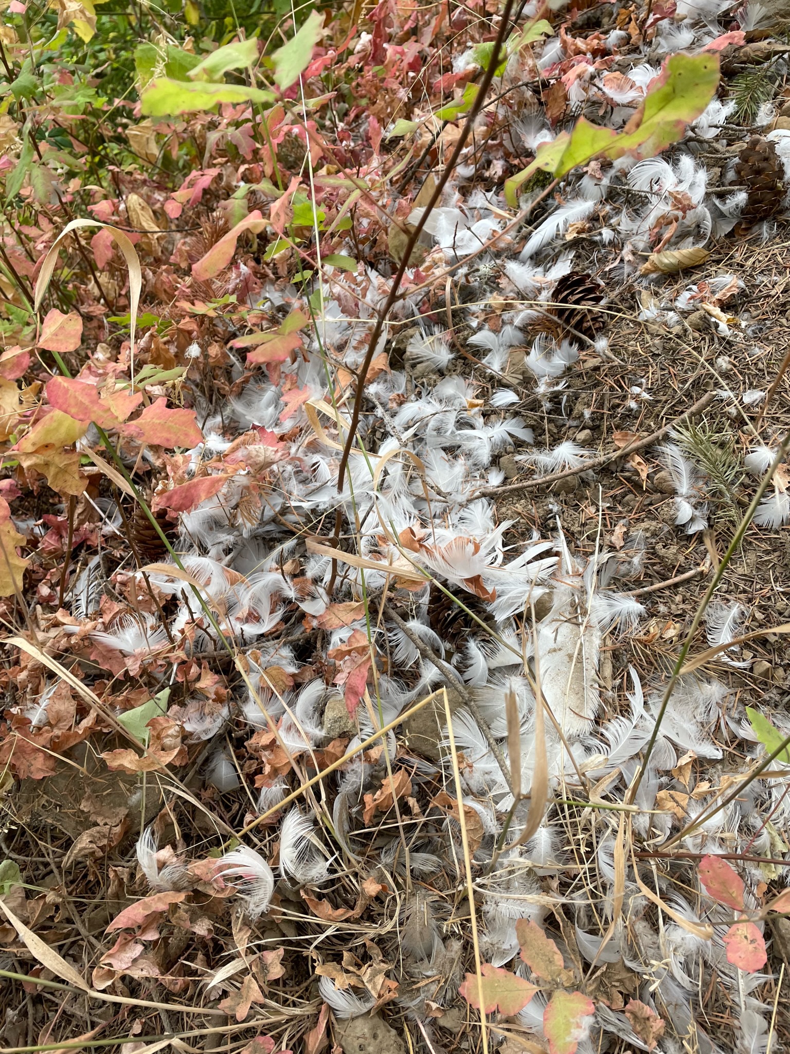
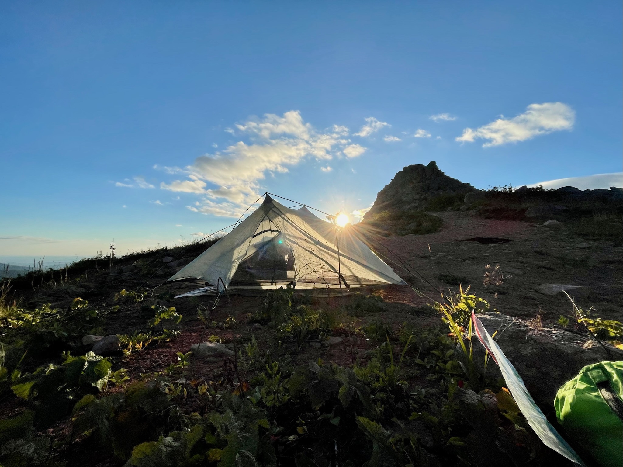
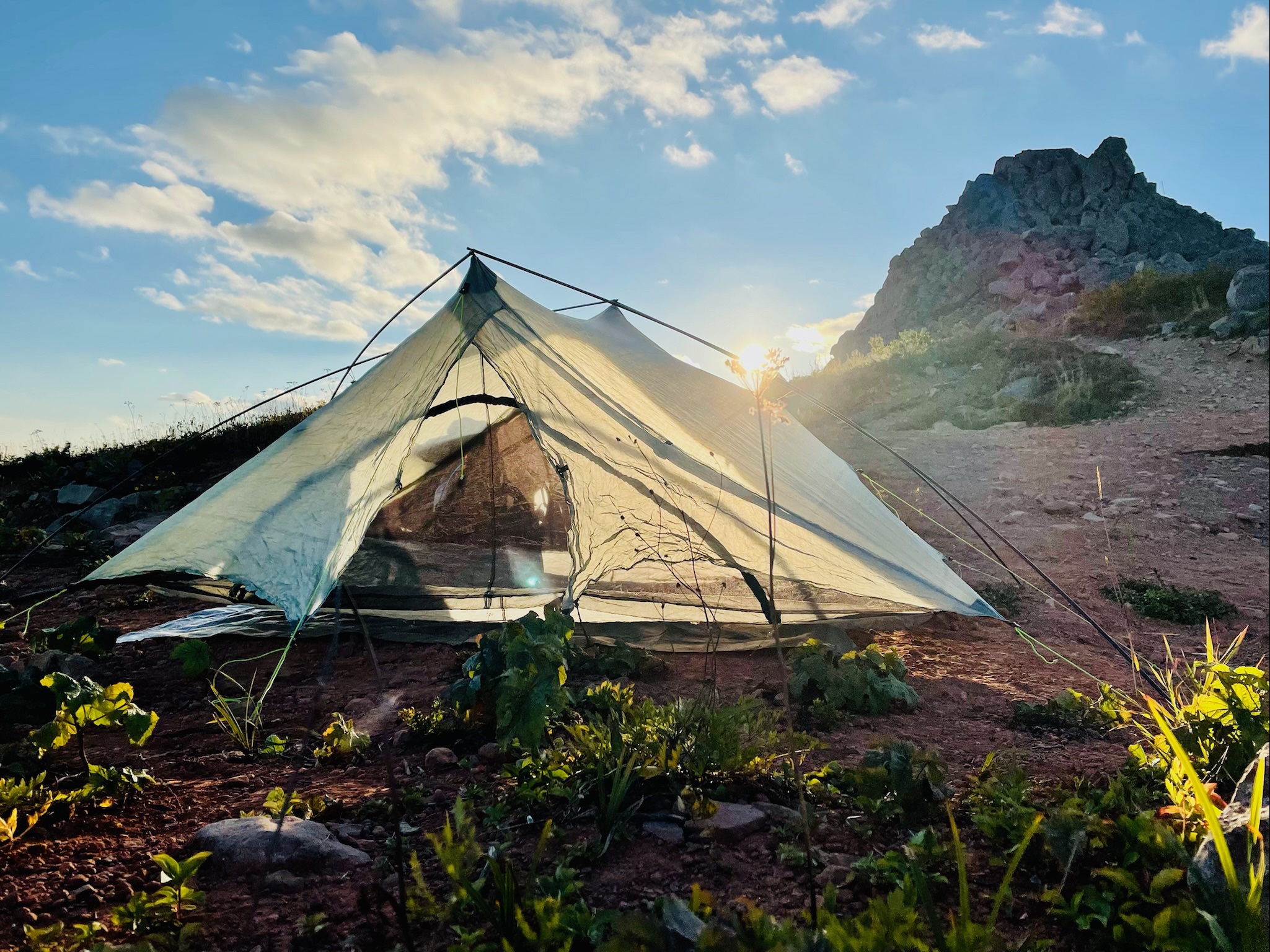
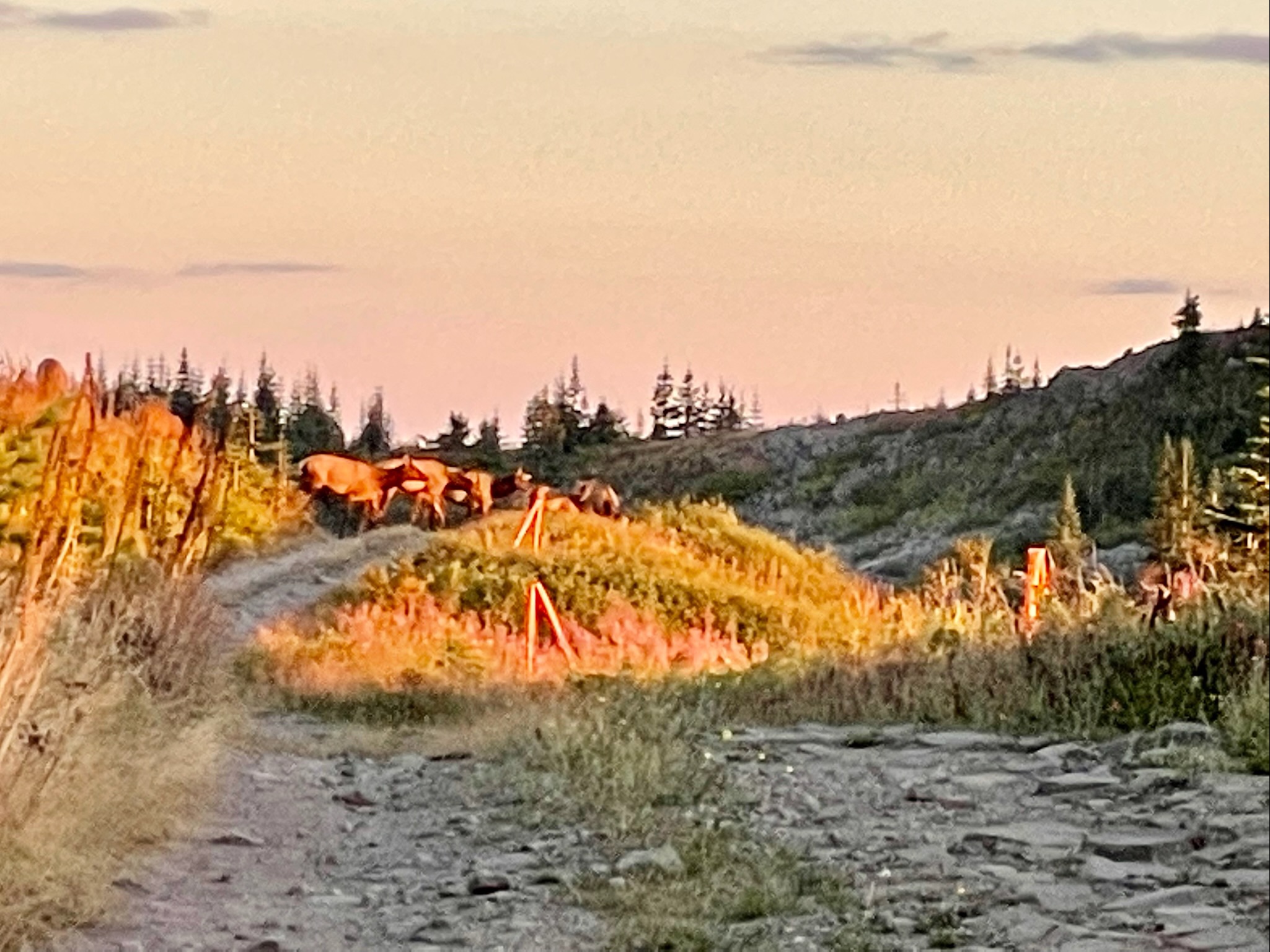
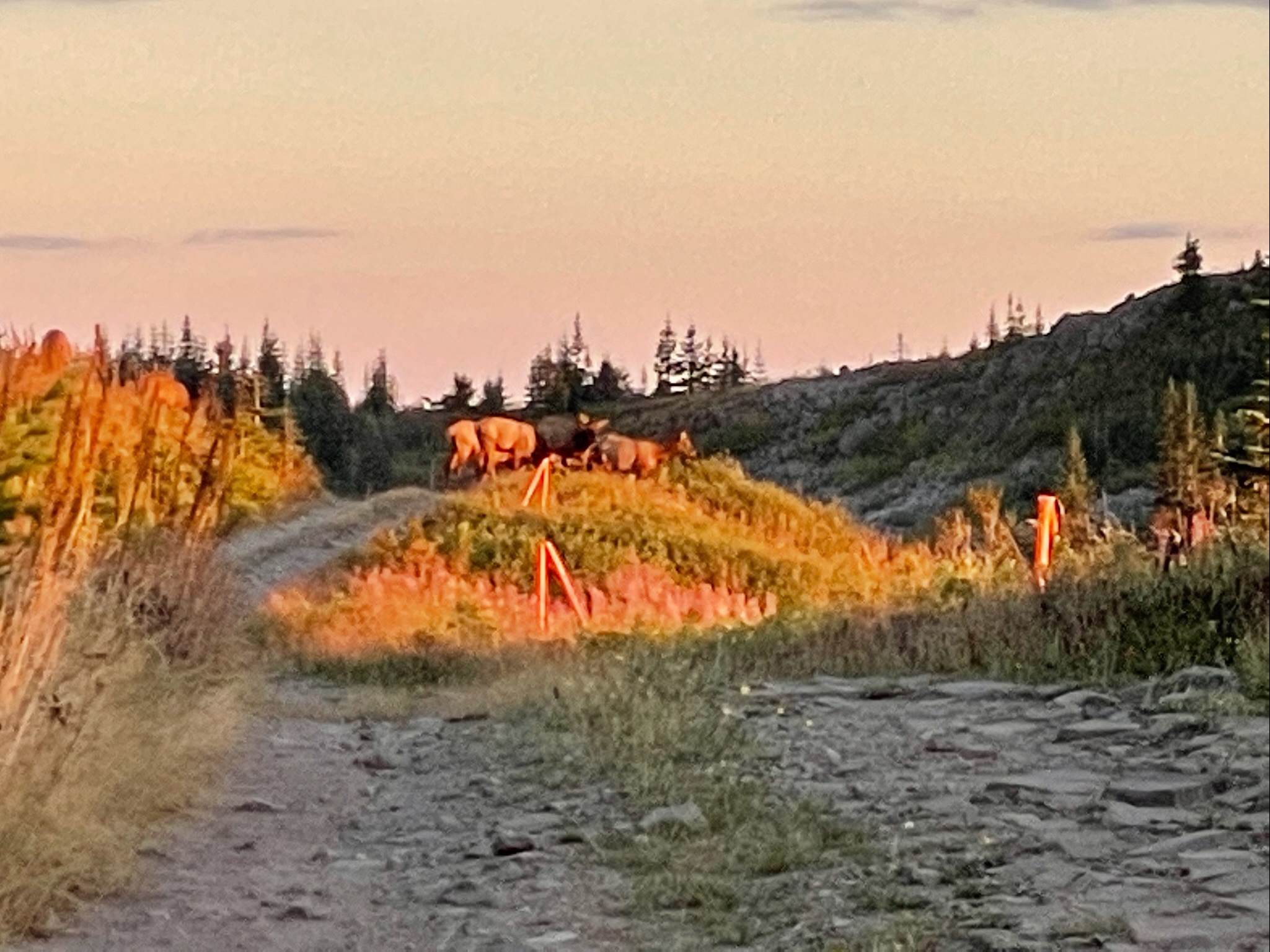
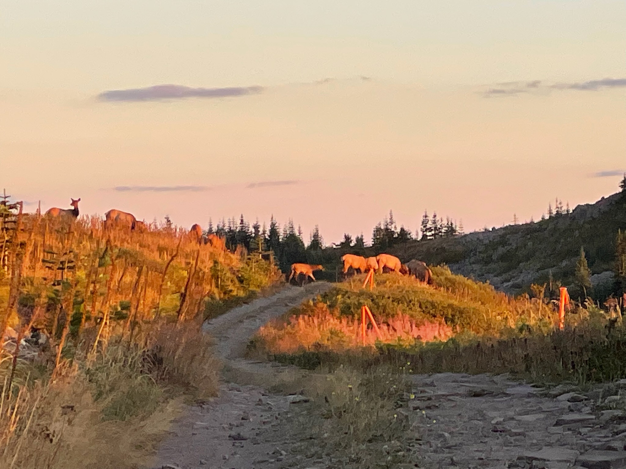
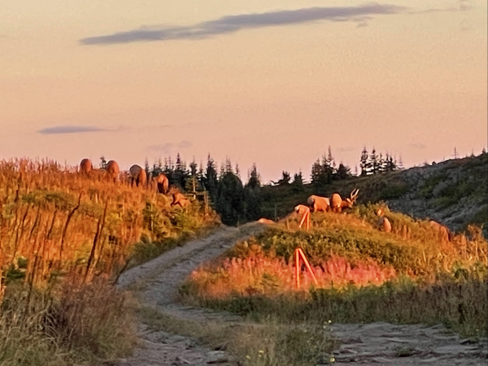
As the wind picked up and the golden hour approached, we headed down from the magnificent views atop the old firetower to set up our tent in a bare dirt patch where it looked like locals came up to party every now and then. Shannon and I sat nearby the old radio tower to cook dinner as we watched the spectacular colors of the stellar sunset to the west. Soon we were joined by Eli, another northbound hiker who had also decided to make the trek to camp up here with us and we welcomed him to the epic campsite. As we were finishing cooking up dinner, Mr. Wobbles ran over to us and exclaimed that there was a bunch of deer or elk directly behind us. We got so excited that we dropped what we were holding, shut off our stoves and ran to go see where he was pointing. Down the dusty service road a large herd of at least 30 absolutely massive elk were grazing amongst the late summer wildflowers and long green grasses. Big baby elk were guarded by protective mamas watching carefully over the herd, their heads on a swivel as they tore loose bundles of fodder from the alpine fields. Mr. Wobbles informed us that he saw 2 of the bull elk fighting each other and they seemed to still be going head-to-head with their massive racks of antlers instead of scanning for predators. I guess elk rutting season is starting soon which means in addition to aggressive 1000 lb animals we’ll also have to watch out for hunters.
With the elk upwind of us, we were able to slowly walk closer to the herd without them smelling us and bolting. Unfortunately with it being the mountains and day transitioning to night, the wind direction changed and all of a sudden the herd scented us hikers and the residual smells we had on us from town – laundry detergent, shampoo, soap. One of the mama elk perked up with the shifting breeze and shifted nervously, staring at her babies and then back to us with intense scrutiny. All of a sudden about a dozen or so enormous elk heads popped up from the golden-green meadow yonder. They sure didn’t like the smell of us yucky PCT hikers and decided to put some distance between us. The herd slowly trotted away towards the woods and far fields on the mountain ridge.
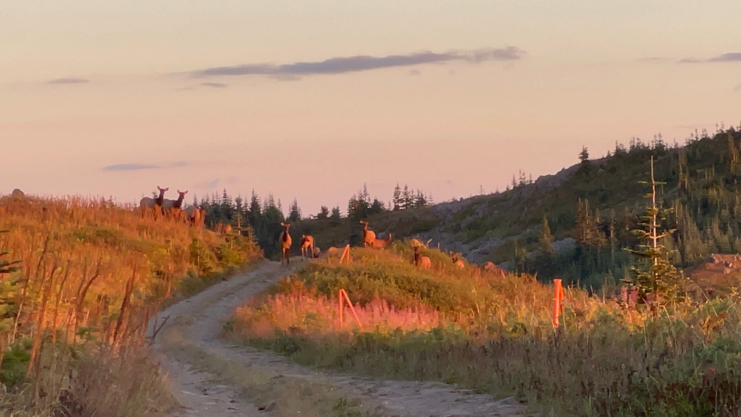
Knowing that we’d only have a limited amount of time before the elk disappeared, Shannon and I grabbed the drone to see if we could spot the herd from far above. We were able to catch a few frames of the elk herd just after the sunset was swallowed up by the high mountain peaks but the animals did not care much for the sound of the drone which was maybe a good thing. I sure didn’t want to get trampled by a half ton testosterone-fueled bull elk in my sleep and they had been getting kind of close to our tent site.
Afterwards, we carefully finished our dinner with our rationed water supply and headed to sleep. The twinkling lights of the river town of Stevenson, Washington shone far below us perched on the cliffs of the dark Columbia River. The stars in the sky above started sprouting out of the teal blue heavens. It seemed like there was smoke or a haze on the horizon combined with some light pollution from larger cities like Portland, OR and Vancouver, WA so the Milky Way wasn’t as striking as it had been in the High Sierras but it was still beautiful.

As we scrambled into our tent, what looked like nocturnal crows or ravens flew by over our heads skimming the woods line. We knew that crows and ravens aren’t night critters and were super confused. Turns out that these flying daredevils were some sort of enormous bat with a wingspan of almost 18 inches! It was weird because they didn’t dart around in zigzags with the agility that the tiny bats we’ve seen in the past do. These guys flew straight like the crow flies which is something we’d never seen before. With the little bit of cell service I had at the peak, I looked up the critters online and it seemed like they could be giant hoary bats that were endangered. How cool!!